My County: Norman History and Heritage
The Norman invasion left its mark in every county throughout the island of Ireland. Such traces are often still clear today, particularly in the names of families and places, but also in the castles and abbeys which characterise Ireland’s landscape. Here you can explore these Norman connections to your own county.
Explore my county
Here you can explore the Norman connections of each of the 32 counties that make up the island of Ireland. For each county, you will find the following resources:
- Introduction to the Gaelic kingdoms that existed at the time of the invasion
- Links to notable people associated with the region through the NAISC Knowledge Graph.
- An example of a surviving medieval monument within the modern county borders.
- Suggestions for further reading on your county.
Together, these resources offer a starting point for exploring how the Norman invasion shaped the history and landscape of each county.
To discover more about the monuments in your locality, check out:
The 32 counties of Ireland are listed below in alphabetical order. Click on a county name to jump directly to its historical introduction and associated digital resources further down this page.
Antrim
What is now the county of Antrim was part of the medieval over-kingdom of the Ulaid, the ruling dynasty in which at the time of the Anglo-Norman invasion bore the surname Mac Duinn Sléibe (modern MacDonleavy). To discover more about those connected with the Norman expansion into the region, see:
Also, check out our Knowledge Graph linked events for this county:
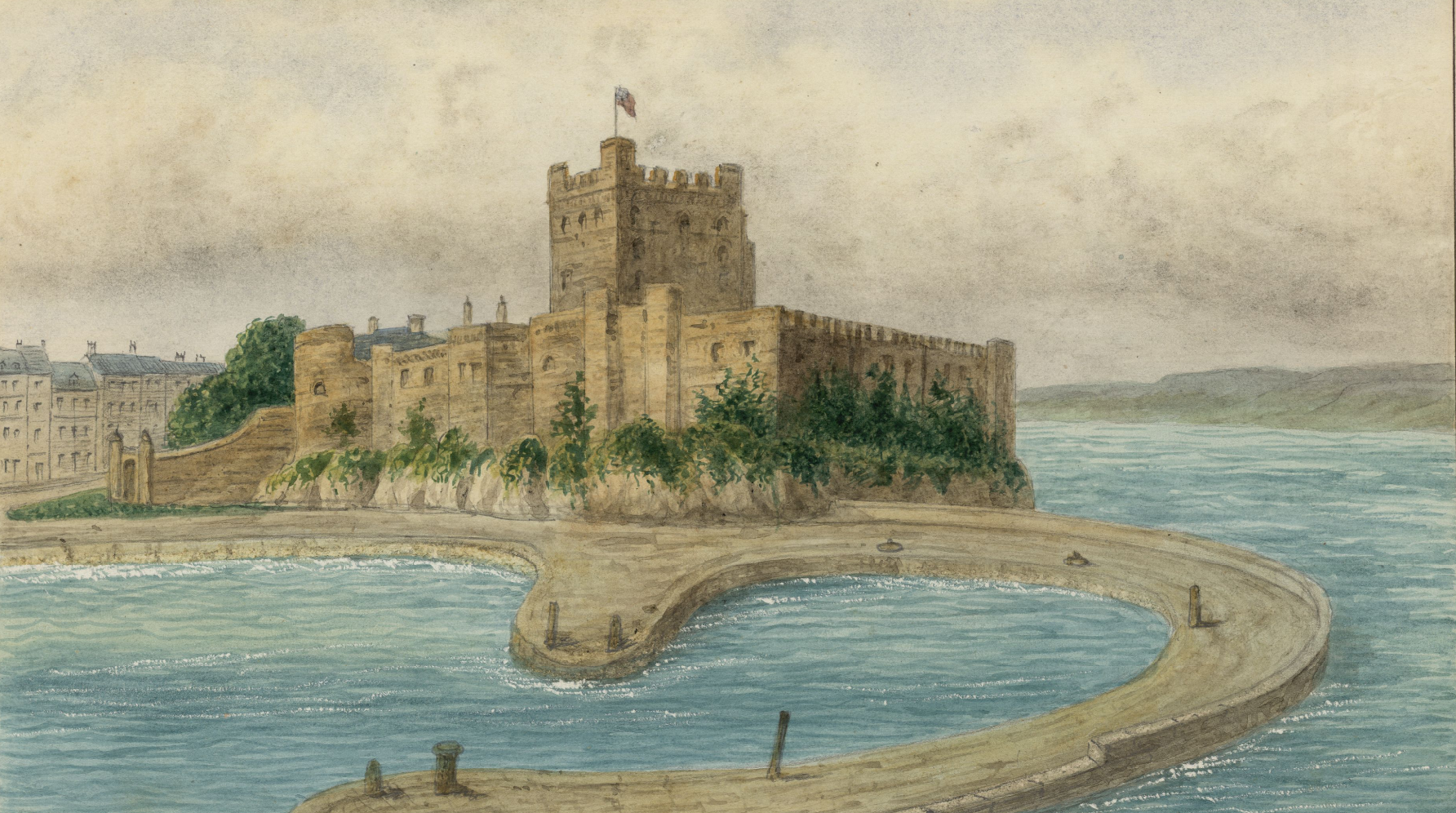
To explore Norman monuments in co. Antrim such as Carrickfergus castle (pictured), check out the Historic Environment Viewer for Northern Ireland
For more information on the Normans in Antrim, see:
- Edmund Curtis, ‘Sheriffs’ accounts of the Honor of Dungarvan, of Tweskard in Ulster, and of County Waterford, 1261-63’, Proceedings of the Royal Irish Academy C, Vol. 39 (1929/31) pp. 1-17; and for the original documentation, see https://www.virtualtreasury.ie/item/PUB-CurtisEdmund1943-209044
- Seán Duffy, ‘The first Ulster plantation: John de Courcy and the men of Cumbria’ in Terry Barry, Robin Frame and Katharine Simms (eds), Colony and frontier in medieval Ireland. Essays presented to JF Lydon (London, 1995), pp. 1-27.
- Katharine Simms, ‘The Medieval Chieftains in County Antrim: Irish, English, Scots and Welsh’ in Eileen Murphy and Colm Donnelly (eds), Antrim: History and Society. Interdisciplinary Essays on the History of an Irish County (Dublin, 2025).
To learn more about the county of Antrim and its history more generally, check out our ‘Knowledge Graph for Irish History’: https://kg.virtualtreasury.ie/place/present-day/county/Antrim/v11w9gm
Armagh
What is now the county of Armagh was, at the time of the Anglo-Norman invasion, mostly part of the medieval kingdom of Airthir, in which the dominant dynasty was then the Uí Anluain (later O’Hanlons). To discover more about those connected with the Norman expansion into the region, see:
Also, check out our Knowledge Graph linked events for this county:
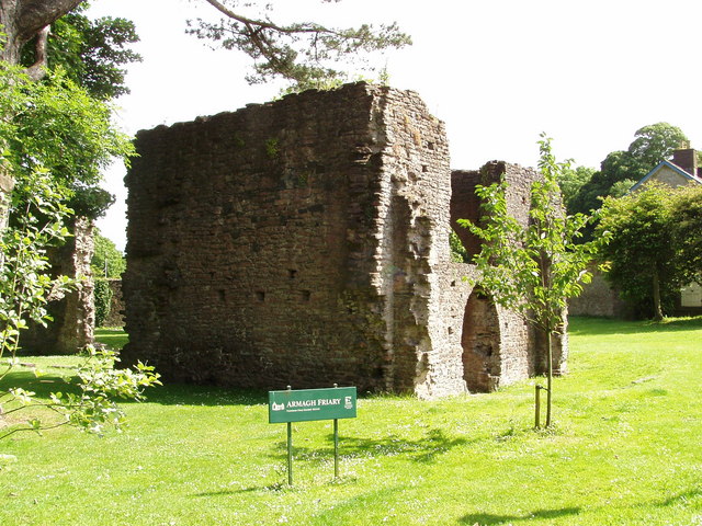
To explore Norman monuments in co. Armagh such as the Armagh Franciscan friary (pictured), check out the Historic Environment Viewer for Northern Ireland
Discover notable people connected with this county through our ‘Knowledge Graph for Irish History’: https://kg.virtualtreasury.ie/place/present-day/county/Armagh/v1s48xf
For more information on the Normans in Armagh, see:
- Katharine Simms, ‘Medieval Armagh: The Kingdom of Oirthir (Orior) and its Rulers the Uí Annluain (O’Hanlons)’ in A.J. Hughes and William Nolan (eds), Armagh: History & Society. Interdisciplinary Essays on the History of an Irish County (Dublin, 2001).
- The Register of Milo Sweteman, Archbishop of Armagh 1361-1380 (Dublin, 1996).
To learn more about the county of Armagh and its history more generally, check out our ‘Knowledge Graph for Irish History’: https://kg.virtualtreasury.ie/place/present-day/county/Armagh/v1s48xf
Carlow
What is now the county of Carlow, at the time of the Anglo-Norman invasion formed the territory of a number of competing dynasties, including the Fotharta whose kings were the Uí Nualláin (later O’Nolan), Uí Dróna, in which the chief dynasty was Uí Riain (O’Ryans), and Uí Bairrche led by the Uí Gormáin (O’Gormans). But all were coming under pressure from the Uí Chennselaig, ruled over by Diarmait Mac Murchada, over-king of Leinster. To discover more about those connected with the Norman expansion into the region, see:
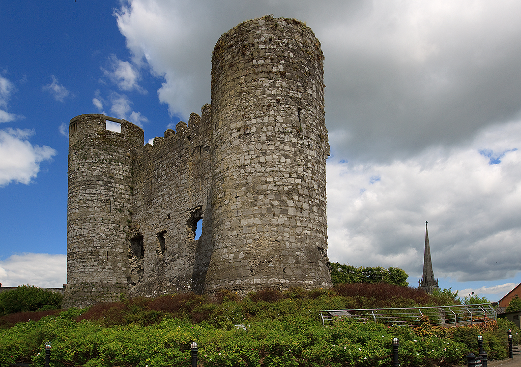
To explore Norman monuments in co. Carlow such as Carlow castle (pictured), check out the National Monuments Service’s Historic Environment Viewer.
For more information on the Normans in Carlow, see:
- William Nolan (ed.), Carlow: History and Society. Interdisciplinary Essays on the History of an Irish County (Dublin, 2008), especially chapters by Canon Adrian Empey, ‘The Liberty and counties of Carlow in the high Middle Ages’; Linda Doran, ‘Medieval settlement hierarchy in Carlow and the ‘Carlow Corridor’ 1200-1550’; Colum Kenny, ‘New Leighlin: an Anglo-Norman settlement’; and Margaret Murphy, ‘Tullow – from medieval manor to market town’.
- Canon Adrian Empey, ‘The medieval county of Carlow 1169-1245: the formative years’, Carloviana, 63 (2015) pp. 156-160.
- Goddard Henry Orpen, ‘The Castle of Raymond le Gros at Fodredunolan’, The Journal of the Royal Society of Antiquaries of Ireland, Vol. 36 (1906) pp. 368-382.
To learn more about the county of Carlow and its history more generally, check out our ‘Knowledge Graph for Irish History’: https://kg.virtualtreasury.ie/place/present-day/county/Carlow/v1fkv62
Cavan
What is now the county of Cavan was part of the medieval kingdom of Bréifne, the eastern part of which was ruled at the time of the Anglo-Norman invasion by the Uí Ragallaigh (later, O’Reilly) and the western part by the Uí Ruairc (later, O’Rourke). To discover more about those connected with the Norman expansion into the region, see:
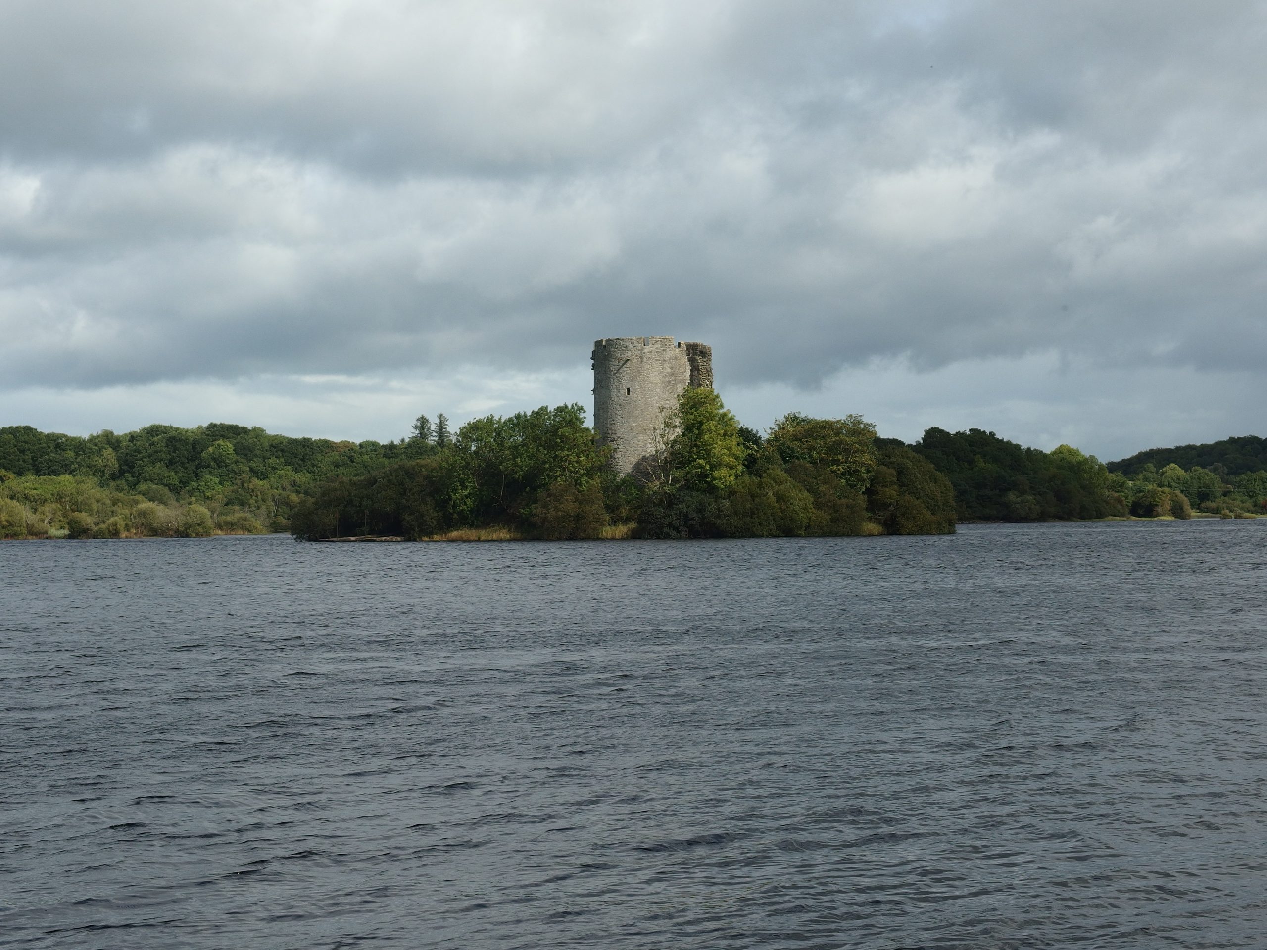
To explore Norman monuments in co. Cavan such as the motte-and-bailey on Turbet island (pictured), check out the National Monuments Service’s Historic Environment Viewer.
For more information on the Normans in Cavan, see:
- Linda Shine, ‘Frontier settlement in Cavan in the high medieval period (1169-1550)’ in Jonathan Cherry and Brendan Scott (eds), Cavan: History and Society. Interdisciplinary Essays on the History of an Irish County (Dublin, 2014).
To learn more about the county of Cavan and its history more generally, check out our ‘Knowledge Graph for Irish History’: https://kg.virtualtreasury.ie/place/present-day/county/Cavan/v18xdn2
Clare
What is now the county of Clare was part of the medieval kingdom of Tuadmumain (North Munster, Thomond), ruled by a Dál Cais dynasty descended from Brian Boru and hence called the Uí Briain (later, O’Brien). To discover more about those connected with the Norman expansion into the region, see:
Also, check out our Knowledge Graph linked events for this county:
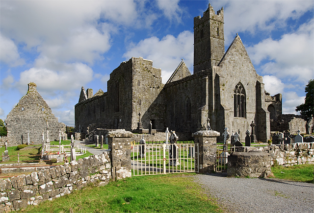
To explore Norman monuments in co. Clare such as the remains of Thomas de Clare’s castle at Quin abbey (pictured), check out the National Monuments Service’s Historic Environment Viewer.
For more information on the Normans in Clare, see:
- David Nally, ‘Maintaining the Marches: Seigneur, Sept and Settlement in Anglo-Norman Thomond’ in Matthew Lynch and Patrick Nugent (eds), Clare: History and Society. Interdisciplinary Essays on the History of an Irish County (Dublin, 2008).
To learn more about the county of Clare and its history more generally, check out our ‘Knowledge Graph for Irish History’: https://kg.virtualtreasury.ie/place/present-day/county/Clare/v18myt6
Cork
What is now the county of Cork was part of the medieval kingdom of Deasmumain (South Munster, Desmond), ruled at the time of the Anglo-Norman invasion by the Meic Carthaig (MacCarthy family). To discover more about those connected with the Norman expansion into the region, see:
Also, check out our Knowledge Graph linked events for this county:
To explore Norman monuments in co. Cork such as Liscarroll castle (pictured), check out the National Monuments Service’s Historic Environment Viewer.
For more information on the Normans in Cork, see:
- Paul MacCotter, A History of the Medieval Diocese of Cloyne (Dublin, 2013).
- —’Anglo-Normans in the Mallow area’, Mallow Field Club Journal, Vol. 22 (2004) pp. 49-60.
- —’Norman and Gael in the Bandon Valley’, Journal of the Cork Historical and Archaeological Society, Vol. 122 (2017) pp. 1-16.
- —’The Carews of Cork’, Journal of the Cork Historical and Archaeological Society, Part 1, Vol. 98 (1993) pp. 61-74; Part 2, Vol. 99 (1994) pp. 66-82.
- —’The Fitzgeralds of Imokilly’ in The Book of Cloyne (Cloyne, 1993), pp. 79-99.
- —’The sub-infeudation and descent of the Fitzstephen/Carew moiety of Desmond’, Journal of the Cork Historical and Archaeological Society, Part 1, Vol. 101 (1996) pp. 64-80; Part 2, Vol. 102 (1997) pp. 89-106.
- Paul MacCotter and Kenneth Nicholls (eds), The Pipe Roll of Cloyne: Rotulus Pipae Clonensis (Cloyne, 1996).
- A.F. O’Brien, ‘Politics, economy and society: the development of Cork and the Irish south-coast region c.1170 to c.1583’ in Patrick O’Flanagan, Cornelius G. Buttimer and Gerard O’Brien (eds), Cork: History and Society. Interdisciplinary Essays on the History of an Irish County (Dublin, 1993).
To learn more about the county of Cork and its history more generally, check out our ‘Knowledge Graph for Irish History’: https://kg.virtualtreasury.ie/place/present-day/county/Cork/v1h23tp
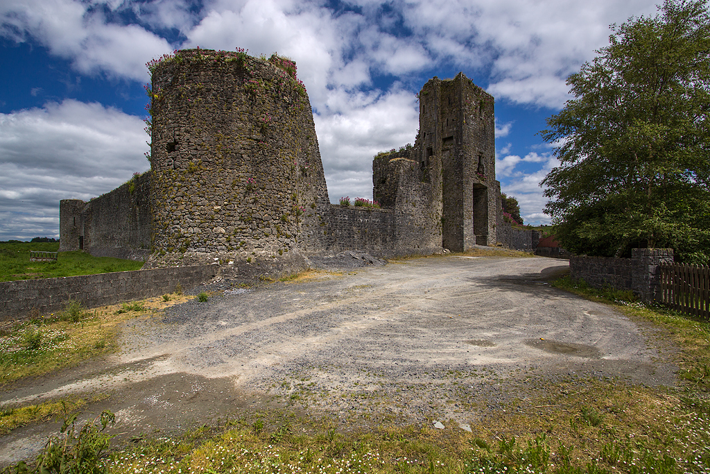
Derry/Londonderry
What is now the county of Derry/Londonderry, at the time of the Anglo-Norman invasion formed the territory of a number of competing dynasties, being under the influence of the Cenél nEógain in the west, ruled by the Mac Lochlainn family, the east being part of Ciannacht and the territory of Fir na Craíbe, where the dominant dynasty was the Uí Chathain (O’Kane). To discover more about those connected with the Norman expansion into the region, see:
Also, check out our Knowledge Graph linked events for this county:
To explore Norman monuments in co. Derry/Londonderry such as Dungiven Priory (pictured), check out the Historic Environment Viewer for Northern Ireland.
For more information on the Normans in Derry/Londonderry, see:
- Katharine Simms, ‘Tír Eoghain “North of the Mountain”’, in Gerard O’Brien and William Nolan (eds), Derry and Londonderry: History and Society. Interdisciplinary Essays on the History of an Irish County (Dublin, 1999).
To learn more about the county of Derry/Londonderry and its history more generally, check out our ‘Knowledge Graph for Irish History’: https://kg.virtualtreasury.ie/place/present-day/county/Londonderry/v1v2r9j
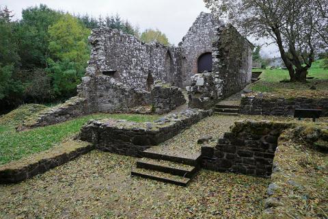
Donegal
What is now the county of Donegal was part of the medieval kingdom of the Cenél Conaill whose dominant dynasty, soon after the Anglo-Norman invasion, adopted the surname Uí Domnaill (O’Donnell). To discover more about those connected with the Norman expansion into the region, see:
Also, check out our Knowledge Graph linked events for this county:
To explore Norman monuments in co. Donegal such as Donegal castle (pictured), check out the National Monuments Service’s Historic Environment Viewer.
For more information on the Normans in Donegal, see:
- Goddard Henry Orpen, ‘The Normans in Tirowen and Tirconnell’, The Journal of the Royal Society of Antiquaries of Ireland Ser. 6, Vol. 5 (1915) pp. 275-288.
- Katharine Simms, ‘Late Medieval Donegal’ in William Nolan, Liam Ronayne and Mairead Dunlevy (eds), Donegal: History and Society. Interdisciplinary Essays on the History of an Irish County (Dublin, 1995).
To learn more about the county of Donegal and its history more generally, check out our ‘Knowledge Graph for Irish History’: https://kg.virtualtreasury.ie/place/present-day/county/Donegal/v14g1sb
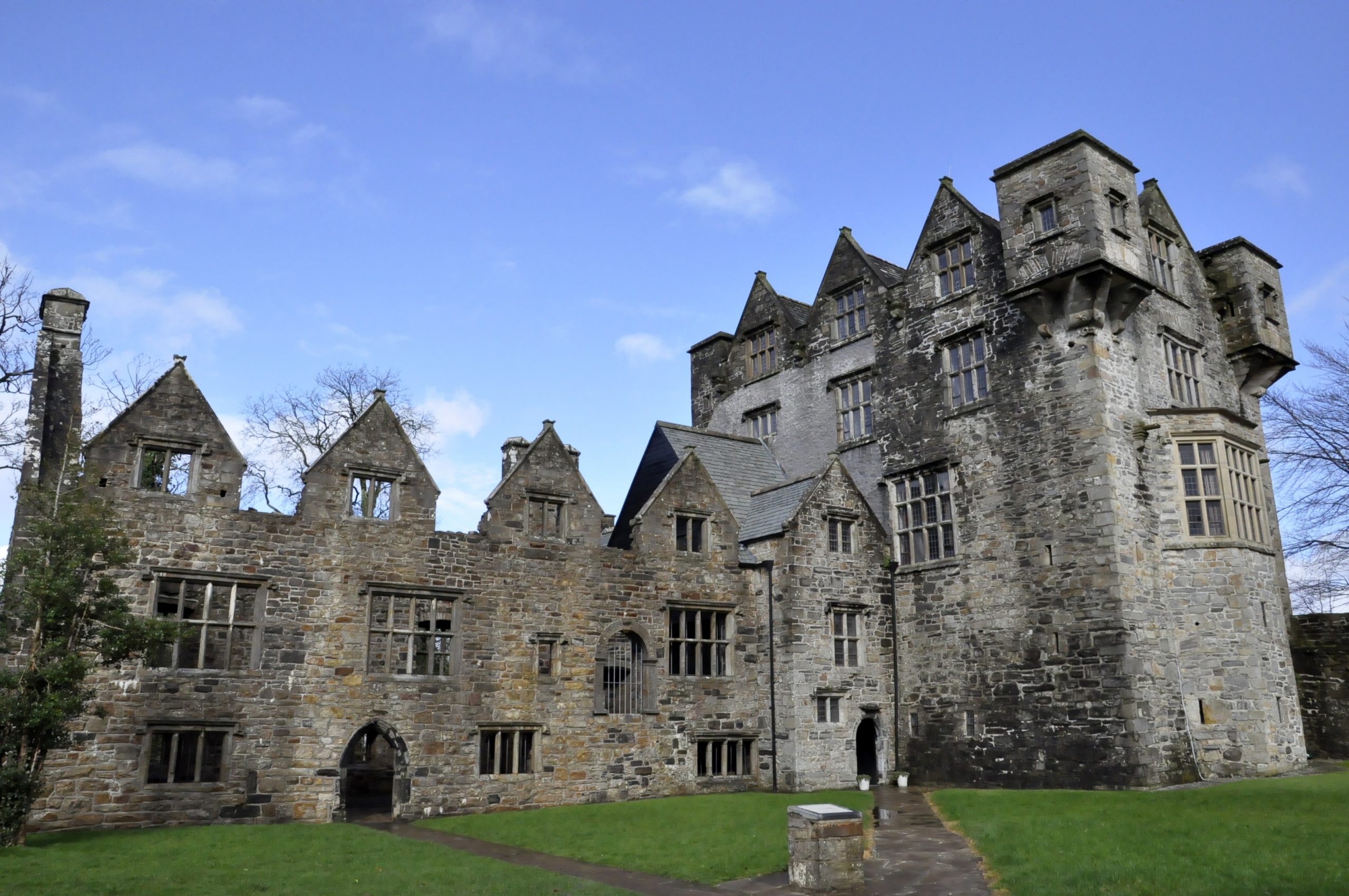
Down
What is now the county of Down does not correspond to the territory of one single dynasty at the time of the Anglo-Norman invasion. Of those who dominated, we find in the north of the county the Dál Fiatach, whose chief family at that point bore the surname Mac Duinn Sléibe (MacDonleavy). In the southern parts of the county we find the Uí Echach kingdoms, one of the leading branches of which would give us the surname Mac Óengussa (MacGuinness). To discover more about those connected with the Norman expansion into the region, see:
Also, check out our Knowledge Graph linked events for this county:
To explore Norman monuments in co. Down such as Dundrum castle (pictured), check out the Historic Environment Viewer for Northern Ireland.
For more information on the Normans in Down, see:
T.E. McNeill, ‘County Down in the Later Middle Ages’ in Lindsay Proudfoot (ed.), Down: History and Society. Interdisciplinary Essays on the History of an Irish County (Dublin, 1997).
Goddard Henry Orpen, ‘Dundrum Castle, County Down, Identified with the “Castrum de Rath”’, The Journal of the Royal Society of Antiquaries of Ireland, Vol. 39 (1909) pp. 23-29.
To learn more about the county of Down and its history more generally, check out our ‘Knowledge Graph for Irish History’: https://kg.virtualtreasury.ie/place/present-day/county/Down/v15h6sz
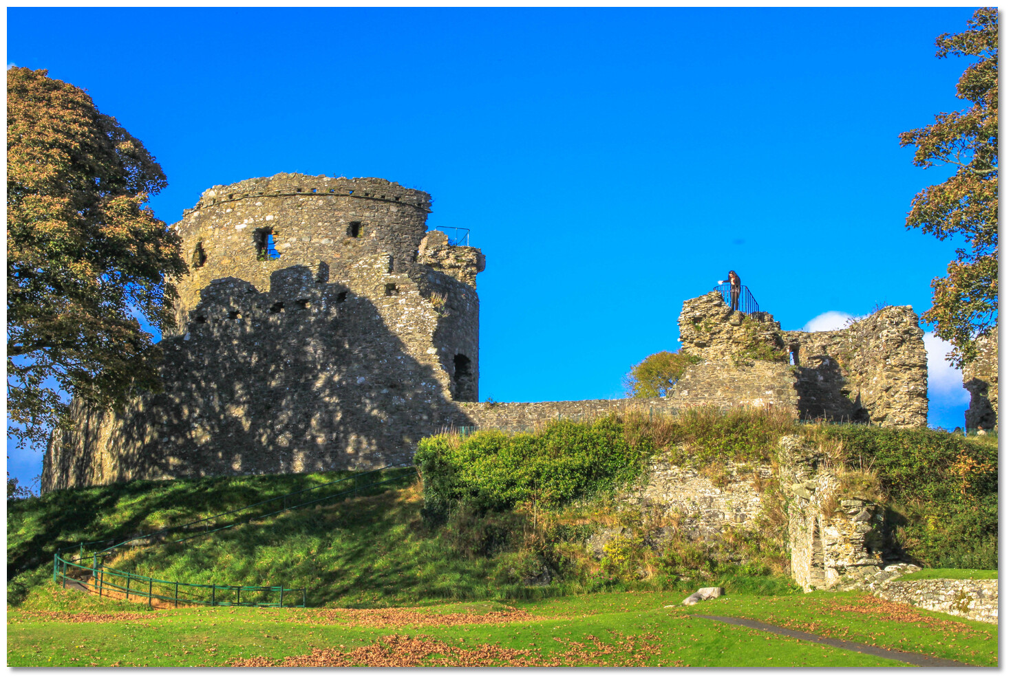
Dublin
Dublin was the first county established in Ireland in the aftermath of the Anglo-Norman invasion, its boundaries in the north of the county following the lines of the Hiberno-Norse kingdom of Fine Gall; south of the Liffey, it took in the territory of pre-existing Irish dynasties, most notably the kings of Uí Briúin Chualann who, in the twelfth century, bore the surname Mac Gilla Mo Cholmóc, some of whom are later found under the Anglo-Normans bearing the name fitz Dermot. To discover more about those connected with the Norman expansion into the region, see:
Also, check out our Knowledge Graph linked events for this county:
- Siege and capture of Dublin, 1170
- Expedition of Henry II, 1171-2
- Expedition of John, lord of Ireland, 1185
To explore Norman monuments in co. Dublin, such as Castleknock motte (pictured), check out the National Monuments Service’s Historic Environment Viewer.
For more information on the Normans in Dublin, see:
- Eric St. John Brooks, ‘The grant of Castleknock to Hugh Tyrel’, The Journal of the Royal Society of Antiquaries of Ireland, Vol. 63 (1933) pp. 206-220.
- Seán Duffy (ed.), Medieval Dublin series.
- Kenneth Milne (ed.), Christ Church Cathedral, Dublin: A History (Dublin, 2000).
To learn more about the county of Dublin and its history more generally, check out our ‘Knowledge Graph for Irish History’: https://kg.virtualtreasury.ie/place/present-day/county/Dublin/v1s4kv2
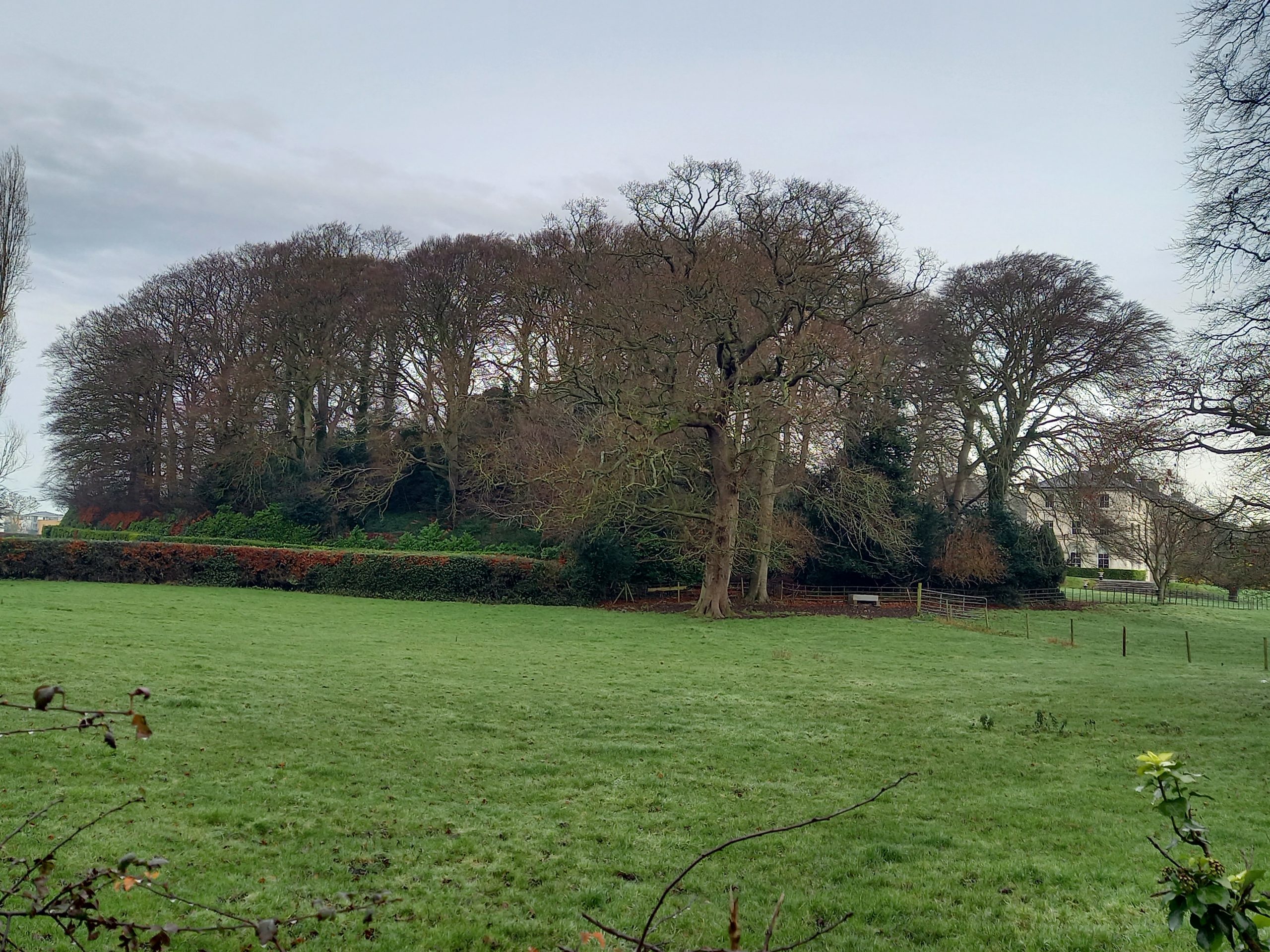
Fermanagh
What is now the county of Fermanagh takes its name from the medieval kingdom of the Fir Manach. At the time of the Anglo-Norman invasion, the kingdom was ruled by the Uí Éignig (O’Heney), but by the early thirteenth century they had been superseded by the Meic Uidhir (Maguire). To discover more about those connected with the Norman expansion into the region, see:
To explore Norman monuments in co. Fermanagh such as Monea castle (pictured), check out the Historic Environment Viewer for Northern Ireland.
For more information on the Normans in Fermanagh, see:
- Katharine Simms, ‘The Medieval Kingdom of Lough Erne’ in Clogher Record, 9:2 (1977), pp 126–41;
- — ‘Medieval Fermanagh’ in Eileen Murphy and William Roulston (eds), Fermanagh: History and Society. Interdisciplinary Essays on the History of an Irish County (Dublin, 2004).
To learn more about the county of Fermanagh and its history more generally, check out our ‘Knowledge Graph for Irish History’: https://kg.virtualtreasury.ie/place/present-day/county/Fermanagh/v11fd6s
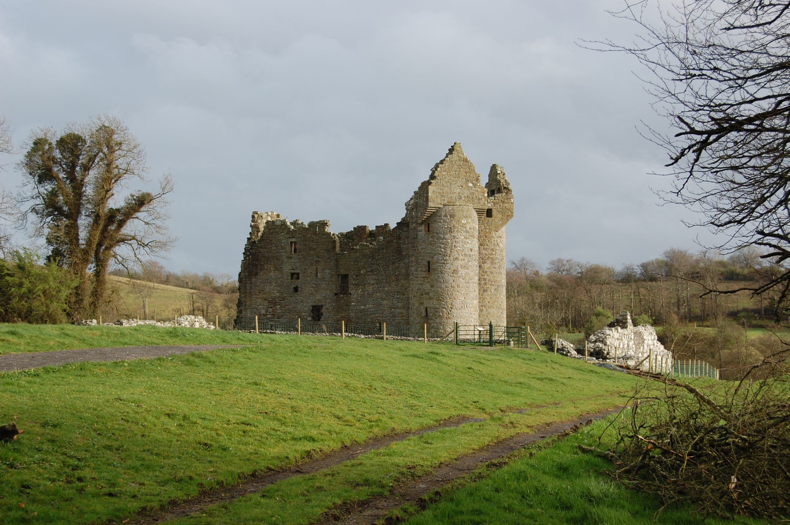
Galway
The present-day county of Galway was, at the time of the Anglo-Norman invasion, under the suzerainty of the Uí Chonchobair (O’Conor) kings of Connacht, headquartered at Tuam. But beneath them are found various sub-kingdoms, including Uí Maine, ruled by the Uí Chellaig (O’Kelly) family, who controlled the eastern portion of the county. West of them, and being pushed further west still, we find Uí Briúin Seola, under the Uí Flaithbhertaig (O’Flaherty), while the most westernly portion of the county was the territory of Conmaicne Mara, from which the modern Connemara is derived . To discover more about those connected with the Norman expansion into the region, see:
Also, check out our Knowledge Graph linked events for this county:
To explore Norman monuments in co. Galway, such as Athenry castle (pictured), check out the National Monuments Service’s Historic Environment Viewer.
For more information on the Normans in Galway, see:
- Edmund Curtis, ‘Feudal Charters of the De Burgo Lordship of Connacht, 1237-1325’ in John Ryan (ed.), Féil-sgríbhinn Eóin Mhic Néill. Essays and studies presented to Professor Eoin MacNeill (Dublin, 1940), pp. 286-295.
- —’Original documents relating to Aughrim, Burrishoole and Aran’, Journal of the Galway Archaeological and Historical Society, Vol. 16 (1934/35) pp. 134-139.
- —’Original Documents Relating to the Butler Lordship of Achilles, Burrishoole and Aughrim (1236-1640)’, Journal of the Galway Archaeological and Historical Society, Vol. 15 (1932) pp. 121-128.
- Goddard Henry Orpen, ‘Richard de Burgh and the conquest of Connaught’, Journal of the Galway Archaeological and Historical Society Vol. 7 (1911/12) pp. 129-147.
- —‘The Mote of Oldcastle and the Castle of Rathgorgin’, Journal of the Galway Archaeological and Historical Society Vol. 9 (1915/16) pp. 33-44.
- Helen Perros (neé Walton), ‘Crossing the Shannon frontier: Connacht and the Anglo-Normans, 1170-1224’ in Terry Barry, Robin Frame and Katharine Simms (eds), Colony and frontier in medieval Ireland. Essays presented to JF Lydon (London, 1995), pp. 117-138.
- Paul Walsh, ‘The topography of the town of Galway in the medieval and early modern periods’ in Gerard Moran and Raymond Gillespie (eds), Galway: History and Society. Interdisciplinary Essays on the History of an Irish County (Dublin, 1996).
To learn more about the county of Galway and its history more generally, check out our ‘Knowledge Graph for Irish History’: https://kg.virtualtreasury.ie/place/present-day/county/Galway/v192xpz
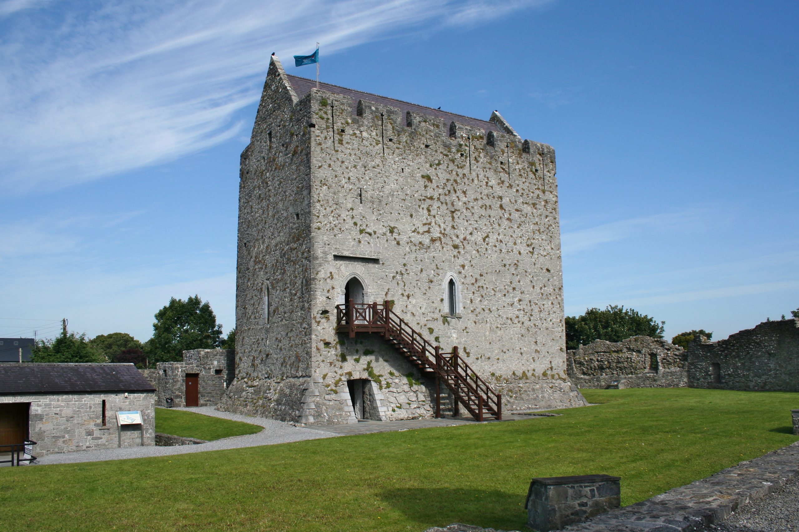
Kerry
The medieval county of Kerry was somewhat smaller than its modern equivalent, much of the south then being part of County Cork. Kerry took its name from an early population-group called the Ciarraige, a prominent branch in the twelfth century being Ciarraige Luachra, under the Uí Chonchobair (O’Conor Kerry). In Corcu Duibne, the Dingle peninsula and his hinterland, are found Uí Ségda (O’Shea) and Uí Failbe (O’Falvey). Around the lakes of Killarney, the kingdom of Eóganacht Locha Léin had as its leading families Uí Muirchertaig (Moriarty) and Uí Donnchada (O’Donoghue), while Uí Súillebáin (O’Sullivan) dominated to the south, though all were coming pressure from the Meic Carthaigh (MacCarthy), overkings of Desmumain (Desmond, South Munster). To discover more about those connected with the Norman expansion into the region, see:
Also, check out our Knowledge Graph linked events for this county:
To explore Norman monuments in co. Kerry, such as Parkavonear Castle (pictured), check out the National Monuments Service’s Historic Environment Viewer.
For more information on the Normans in Kerry, see:
Paul MacCotter, ‘The manor of Castle Island and the cantred of Acmys: people and places’ in Maurice Bric (ed.), Kerry: History and Society. Interdisciplinary Essays on the History of an Irish County (Dublin, 2020).
Goddard Henry Orpen, ‘The Origin of the FitzMaurices, Barons of Kerry and Lixnaw’, The English Historical Review Vol. 29 (1914) pp. 302-314.
To learn more about the county of Kerry and its history more generally, check out our ‘Knowledge Graph for Irish History’: https://kg.virtualtreasury.ie/place/present-day/county/Kerry/v19w8gv
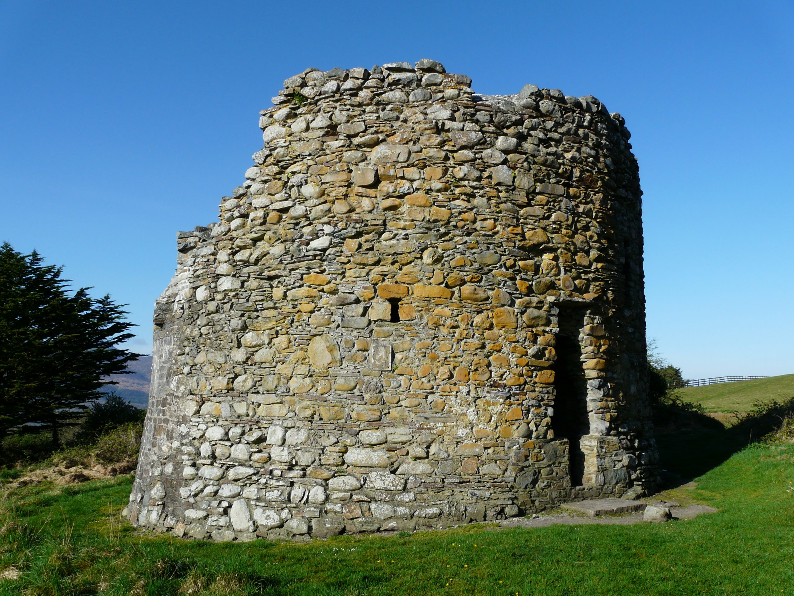
Kildare
The present-day county of Kildare was a patchwork of significant kingdoms at the time of the Anglo-Norman invasion, including Uí Fáeláin, centred at Naas, a branch of whom bearing the surname Ua Broin (O’Byrne) survived the invasion by occupying lands in the Wicklow Mountains, as did the Ua Tuathail (O’Toole) kings of Uí Muiredaig in south Kildare, based around Mullaghmast, while in the west of what became County Kildare we find Uí Conchobair Failge (O’Conor Faly) with their royal seat at Rathangan. To discover more about those connected with the Norman expansion into the region, see:
To explore Norman monuments in co. Kildare, such as Rathmore motte (pictured), check out the National Monuments Service’s Historic Environment Viewer.
For more information on the Normans in Kildare, see:
William Nolan and Thomas McGrath (eds), Kildare: History and Society. Interdisciplinary Essays on the History of an Irish County (Dublin, 2006), especially the chapters by Emmett O’Byrne, ‘Conflict and change: the Irish of Kildare 1000-1269’ and Michael O’Neill, ‘The medieval parish churches of Kildare’.
Eric St. John Brooks, ‘The De Ridelesfords’, The Journal of the Royal Society of Antiquaries of Ireland, Part 1, Vol. 81 (1951) pp. 115-138; Part 2, Vol. 82 (1952) pp. 45-61.
Annette Jocelyn Otway-Ruthven, ‘The medieval county of Kildare’, Irish Historical Studies, Vol. 11 (1959) pp. 181-199.
To learn more about the county of Kildare and its history more generally, check out our ‘Knowledge Graph for Irish History’: https://kg.virtualtreasury.ie/place/present-day/county/Kildare/v1g45vp
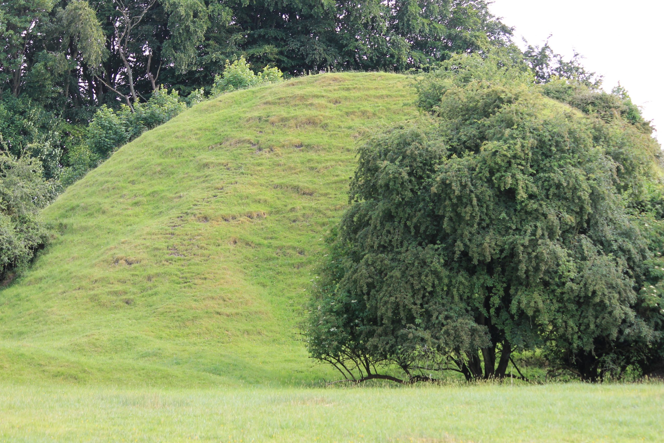
Kilkenny
What is now the county of Kilkenny was part of the medieval kingdom of the Osraige, ruled over by the Meic Gilla Pátraic (MacGillapatrick/Fitzpatrick) family. Underneath this family, in the twelfth century, were a handful of sub-kingdoms among whom we find the Uí Braenáin (O’Brennan) family who controlled the area around Castlecomer, Durrow, and Donaghmore, and, for example, the Uí Dubsláine (Delaney) of Clann Máel Ugra. To discover more about those connected with the Norman expansion into the region, see:
To explore Norman monuments in co. Kilkenny, such as Kells priory (pictured), check out the National Monuments Service’s Historic Environment Viewer.
For more information on the Normans in Kilkenny, see:
- George Dames Burtchaell, ‘The Geraldines of County Kilkenny. Part 1: The Barons of Burnchurch’, The Journal of the Royal Society of Antiquaries of Ireland, 22 (1892) pp. 358-376; Part 2: ‘The Barons of Overk, and the Barons of Knocktopher’, 23 (1983), pp. 179-86; Part 3: ‘The Barons of Brownsford’, 23 (1983), pp. 408-20.
- —‘The Manor of Erley, or Erlestown, County Kilkenny’, The Journal of the Royal Society of Antiquaries of Ireland, 36 (1906), pp. 154-165.
- Canon Adrian Empey, ‘Conquest and Settlement: Patterns of Anglo-Norman Settlement in North Munster and South Leinster’ in James Muldoon (ed.), The North Atlantic frontier of medieval Europe. Vikings and Celts (Farnham, 2009), pp. 257-84.
- —‘The Anglo-Norman Community in Tipperary and Kilkenny in the Middle Ages: Change and Continuity’ in Gearóid MacNiocaill and Pat Wallace (eds), Keimelia: Studies in Medieval Archeology and History in Memory of Tom Delaney (Galway, 1988), pp. 449-467.
- William Nolan and Kevin Whelan (eds), Kilkenny: History and Society. Interdisciplinary Essays on the History of an Irish County (Dublin, 1990), especially chapters by John Bradley, ‘The early development of the medieval town of Kilkenny’ and Canon Adrian Empey, ‘County Kilkenny in the Anglo-Norman period’.
- Goddard Henry Orpen, ‘Motes and Norman Castles in Ossory’, The Journal of the Royal Society of Antiquaries of Ireland, Vol. 39 (1909), pp. 313-342.
To learn more about the county of Kilkenny and its history more generally, check out our ‘Knowledge Graph for Irish History’: https://kg.virtualtreasury.ie/place/present-day/county/Kilkenny/v1w87js
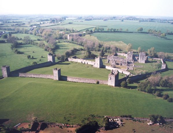
Laois
The present-day county of Laois was part of the medieval kingdom of the Loígis, ruled by the Uí Mórda (O’More) dynasty, though families such as Uí Duinn (O’Dunne) ruled the territory of Uí Riagáin, while the power of Uí Cáellaide was centred on Aghaboe and they were active in north-western region between what would become Counties Kilkenny and Laois, where the Meic Gilla Pátraic kings of the Osraige also exercised influence in the border between the modern-day counties. To discover more about those connected with the Norman expansion into the region, see:
To explore Norman monuments in co. Laois, such as Dunamase castle (pictured), check out the National Monuments Service’s Historic Environment Viewer.
For more information on the Normans in Laois, see:
- Pádraig G. Lane (ed.), Laois: History and Society. Interdisciplinary Essays on the History of an Irish County (Dublin, 1999), especially the chapters by Kieran O’Conor, ‘The impact of the Anglo-Normans in Laois’ and John Bradley, ‘Early urban developments in Co. Laois’.
To learn more about the county of Laois and its history more generally, check out our ‘Knowledge Graph for Irish History’: https://kg.virtualtreasury.ie/place/present-day/county/Laois/v1m55nf
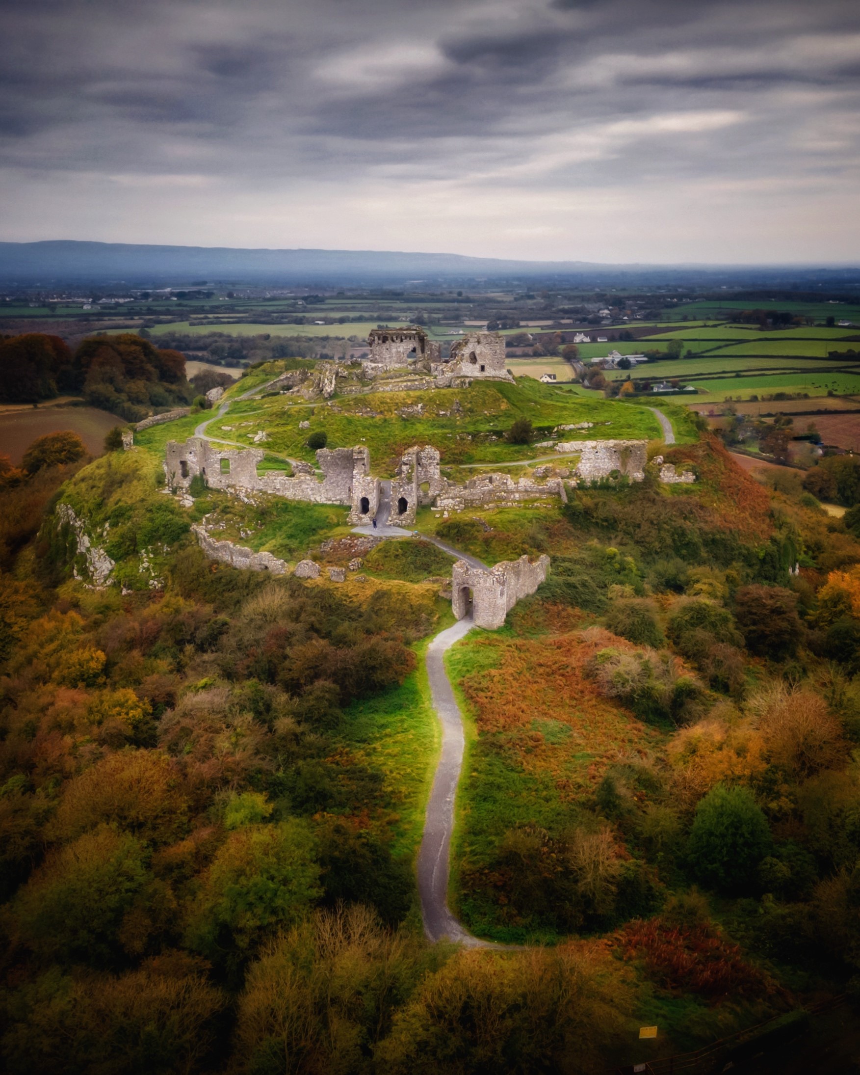
Leitrim
The county of Leitrim was one of the last to be established in Ireland but, at the time of the Anglo-Norman invasion, it was under the overlordship of the kings of Bréifne, the Uí Ruairc (O’Rourke). To discover more about those connected with the Norman expansion into the region, see:
To explore Norman monuments in co. Leitrim such as the Mac Raghnaill castle ruins at Lough Rynn castle (pictured), check out the National Monuments Service’s Historic Environment Viewer.
For more information on the Normans in Leitrim, see:
- Kieran O’Conor and Christina Fredengren, ‘Medieval settlement in Leitrim, c.1169 to c.1380’ in Liam Kelly and Brendan Scott (eds), Leitrim: History and Society. Interdisciplinary Essays on the History of an Irish County (Templeogue, 2019).
To learn more about the county of Leitrim and its history more generally, check out our ‘Knowledge Graph for Irish History’: https://kg.virtualtreasury.ie/place/present-day/county/Leitrim/v1jy1h7
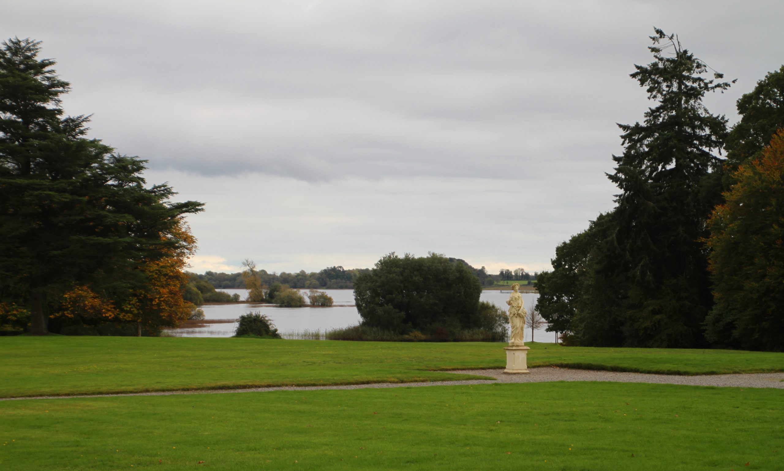
Limerick
What is now the county of Limerick was part of the medieval kingdom of Tuadmumain (Thomond, North Munster), ruled by the Uí Briain (O’Brien) dynasty, who were of Dál Cais and were descended from the great high-king Brian Bóraime (Brian Boru). But beneath them was a range of subordinate kingdoms including, in the south and west of the county, the territory of Uí Donnabáin (O’Donovan) and Uí Coileáin (O’Collins). To discover more about those connected with the Norman expansion into the region, see:
Also, check out our Knowledge Graph linked events for this county:
To explore Norman monuments in co. Limerick such as Kilfinane motte (pictured), check out the National Monuments Service’s Historic Environment Viewer.
For more information on the Normans in Limerick, see:
- Brian Hodkinson, ‘The medieval city’ in Liam Irwin, Gearóid Ó Tuathaigh, and Matthew Potter (eds), Limerick: History and Society. Interdisciplinary Essays on the History of an Irish County (Dublin, 2009).
- Paul MacCotter and Kenneth Nicholls, ‘Feudal warlords: the Knights of Glencorbry’ in T. Donovan (ed.), The Knights of Glin (Glin, 2009), pp. 48-79.
- Goddard Henry Orpen, ‘Notes on some Limerick Castles’, The Journal of the Royal Society of Antiquaries of Ireland, Vol. 39 (1909) pp. 30-41.
To learn more about the county of Limerick and its history more generally, check out our ‘Knowledge Graph for Irish History’: https://kg.virtualtreasury.ie/place/present-day/county/Limerick/v16smv2
Longford
What would much later become the county of Longford at one stage formed a large part of the early kingdom Tethbae but, at the time of the Anglo-Norman invasion, was dominated by Muintir Anghaile bearing the surname Ua Fergail (O’Farrell). To discover more about those connected with the Norman expansion into the region, see:
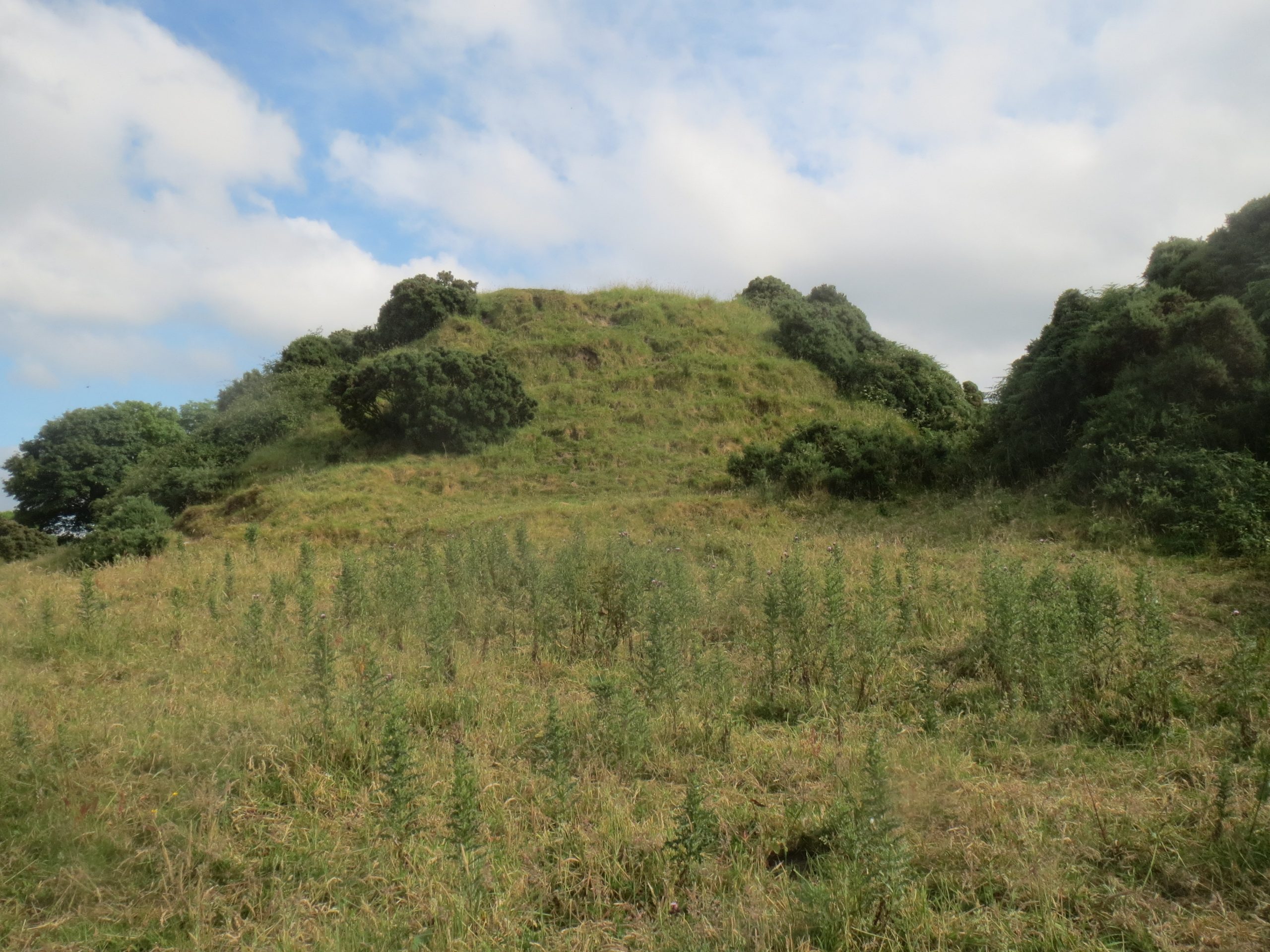
To explore Norman monuments in co. Longford such as Granard motte (pictured), check out the National Monuments Service’s Historic Environment Viewer.
For more information on the Normans in Longford, see:
- Kieran O’Conor and Ciaran Parker, ‘Anglo-Norman settlement in county Longford’ in Martin Morris and Fergus O’Ferrall (eds), Longford: History and Society. Interdisciplinary Essays on the History of an Irish County (Dublin, 2010).
- Goddard Henry Orpen, ‘The Mote of Lisardowlan, County Longford’, The Journal of the Royal Society of Antiquaries of Ireland Vol. 40 (1910) pp. 223-225.
To learn more about the county of Longford and its history more generally, check out our ‘Knowledge Graph for Irish History’: https://kg.virtualtreasury.ie/place/present-day/county/Longford/v14sq9r
Louth
What is now the county of Louth was, by the early twelfth century, part of the medieval kingdom of the Airgialla, then ruled by a family bearing the surname Uí Cerbaill (O’Carroll). After the Anglo-Norman invasion this dynasty would be confined to what is now County Monaghan, its kings being the Meic Mathgamna (Mac Mahons), who exercised little control over what would become Louth. In the north of the county and in Cooley the Uí Anluain (O’Hanlon) were a force to be reckoned with but, overall, County Louth, being very heavily colonised, was a core part of English colony throughout the later Middle Ages. To discover more about those connected with the Norman expansion into the region, see:
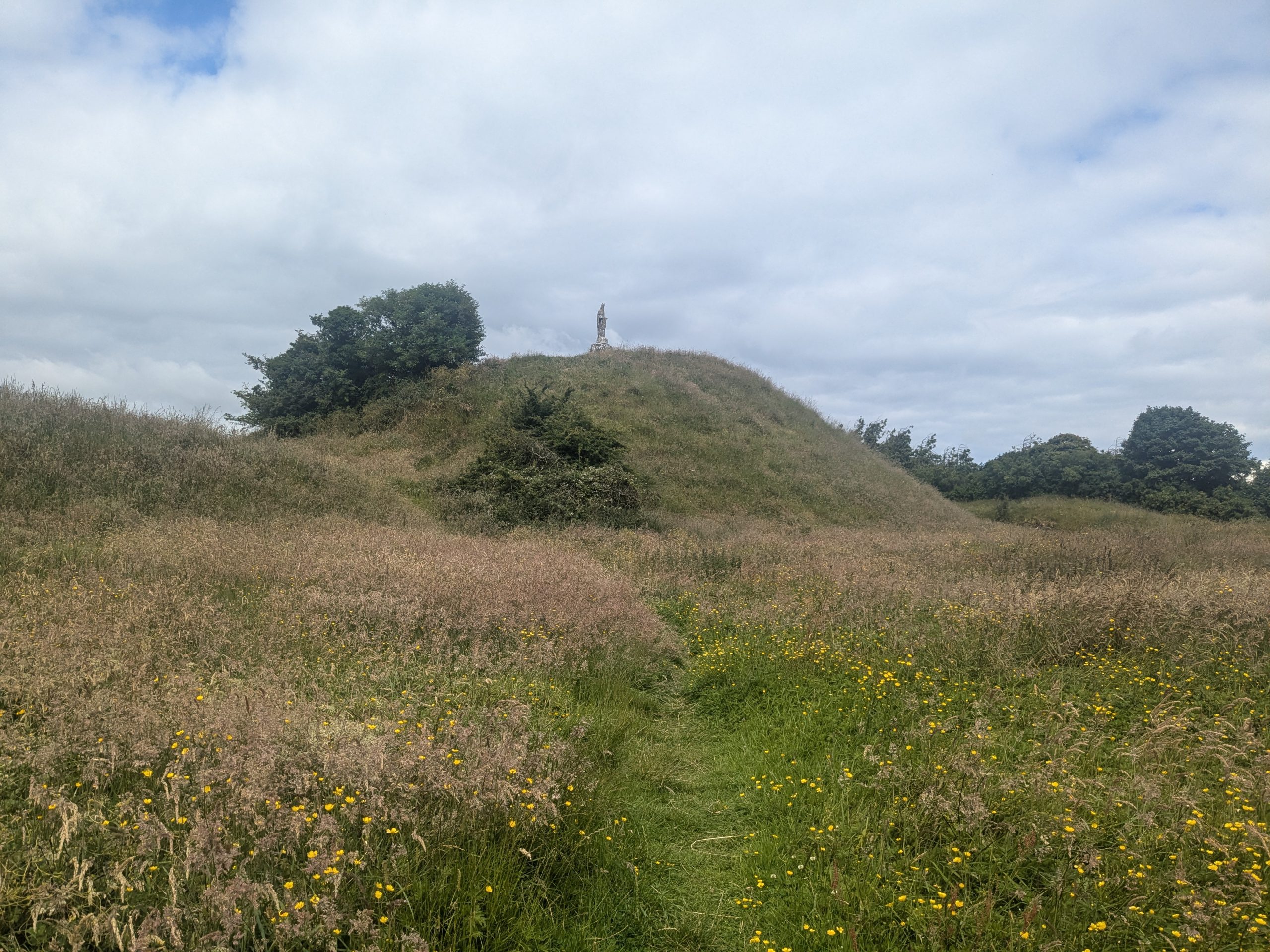
To explore Norman monuments in co. Louth such as Dun Dealgan Motte Castletown/Cuchulainn’s Castle (pictured), check out the National Monuments Service’s Historic Environment Viewer.
For more information on the Normans in Louth, see:
- William Nolan (ed.), Louth History and Society. Interdisciplinary Essays on the History of an Irish County (Dublin, 2023), especially chapters by Micheál Mc Keown, ‘Castle Roche and the de Verdons’; Héléne Bradley Davies, ‘Anglo-Norman rural settlement in county Louth 1189-1350 – a geographical analysis’; Brendan Smith, ‘Colonial Society in Co. Louth, 1150-1450’; and Roger Stalley, ‘Mellifont Abbey: architecture and history’.
- Goddard Henry Orpen, ‘Motes and Norman Castles in County Louth’, The Journal of the Royal Society of Antiquaries of Ireland, Vol. 38 (1908) pp. 241-269.
- James F. Lydon, ‘The county of Uriel account, 1281-1283’, Journal of the County Louth Archaeological and Historical Society, 19 (1977/80), pp. 197-205.
- —’The mills at Ardee in 1304’, Journal of the County Louth Archaeological and Historical Society, 19 (1977/80), pp. 259-63.
- Annette Jocelyn Otway-Ruthven, ‘The partition of the De Verdon lands in Ireland in 1332’, Proceedings of the Royal Irish Academy C, Vol. 66 (1967/68) pp. 401-455.
- Brendan Smith, Colonisation and conquest in medieval Ireland. The English in Louth 1170-1330 (Cambridge, 1999).
- —’Tenure and locality in north Leinster in the early thirteenth century’ in Terry Barry, Robin Frame and Katharine Simms (eds), Colony and frontier in medieval Ireland. Essays presented to JF Lydon (London, 1995), pp. 29-40.
- —’The De Pitchford family in thirteenth-century Ireland’, Studia Hibernica, 27 (1993), pp. 29-43.
To learn more about the county of Louth and its history more generally, check out our ‘Knowledge Graph for Irish History’: https://kg.virtualtreasury.ie/place/present-day/county/Louth/v1hp75j
Mayo
At the time of the Anglo-Norman invasion, what is now county Mayo formed the territory of several kingdoms including, in the north-west and the Moy valley, Uí Fiachrach Muaide whose kings were Ó Dubda, and, around Clew Bay, we find Uí Máille (O’Malley) of Umaill. To discover more about those connected with the Norman expansion into the region, see:
Also, check out our Knowledge Graph linked events for this county:
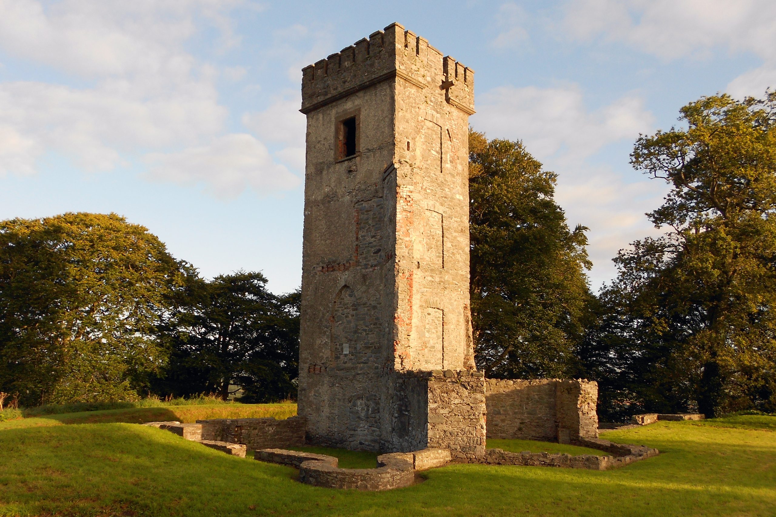
To explore Norman monuments in co. Mayo such as Cong abbey (pictured), check out the National Monuments Service’s Historic Environment Viewer.
For more information on the Normans in Mayo, see:
- Yvonne McDermott, ‘The late medieval friaries of the mendicant orders in County Mayo’ in Gerard Moran and Nollaig Ó Muraíle (eds), Mayo: History and Society. Interdisciplinary Essays on the History of an Irish County (Dublin, 2014).
To learn more about the county of Mayo and its history more generally, check out our ‘Knowledge Graph for Irish History’: https://kg.virtualtreasury.ie/place/present-day/county/Mayo/v1jz66z
Meath
When Henry II granted the kingdom of Mide to Hugh de Lacy in 1172, it was to be held as a lordship ‘as Murchad Ua Maelsechlainn had ever held it’, referring to the last great king of the Uí Maelsechlainn (O’Melaghlin). Once a mighty power on the national stage, by the time of the Anglo-Norman invasion the kingdom of Meath was under increasing pressure from the other provincial kingdoms, including the Uí Ruairc of Bréifne, was very rapidly colonised in the years after 1172, and remained a core part of the English colony for the remainder of the Middle Ages. To discover more about those connected with the Norman expansion into the region, see:
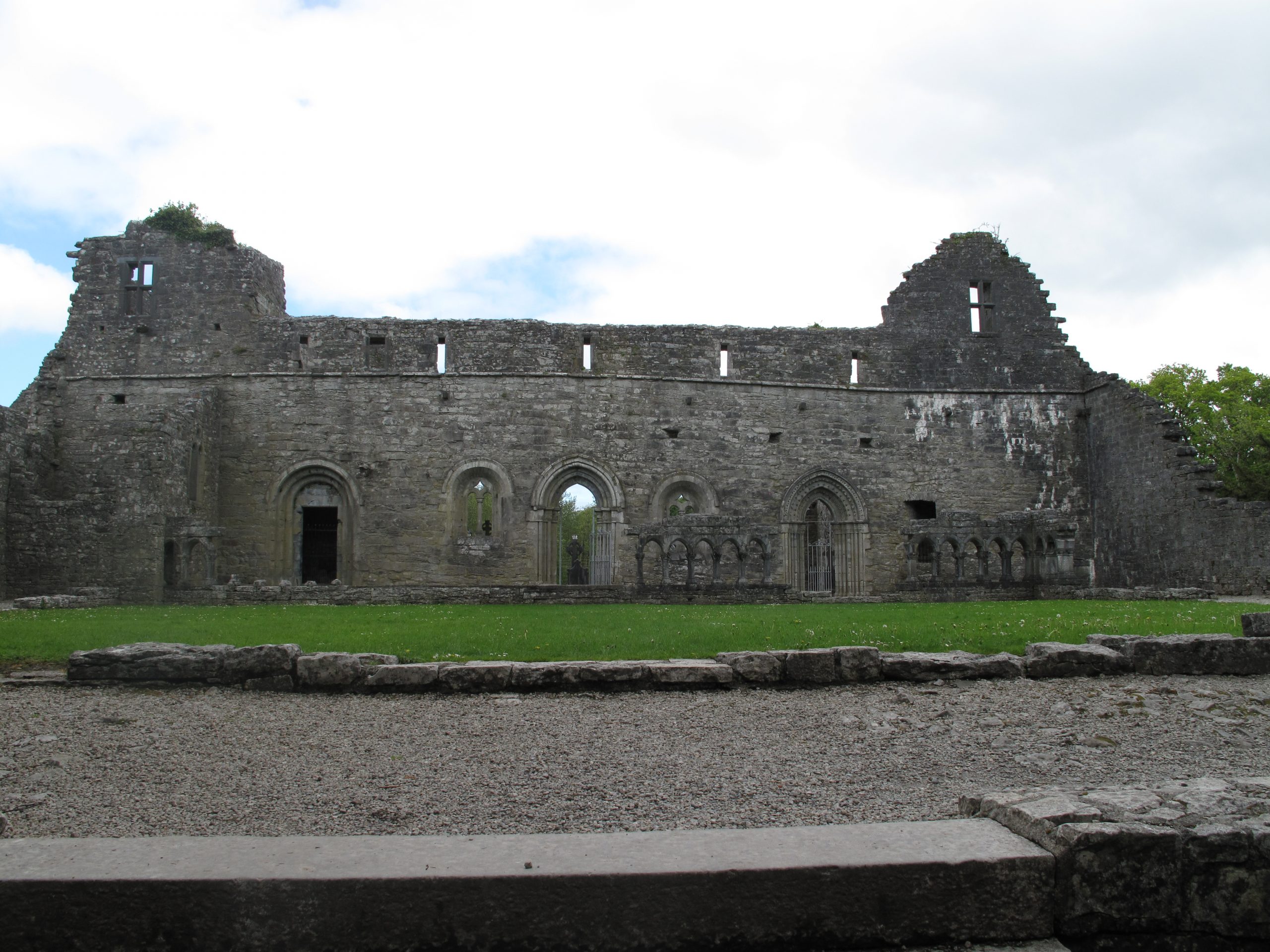
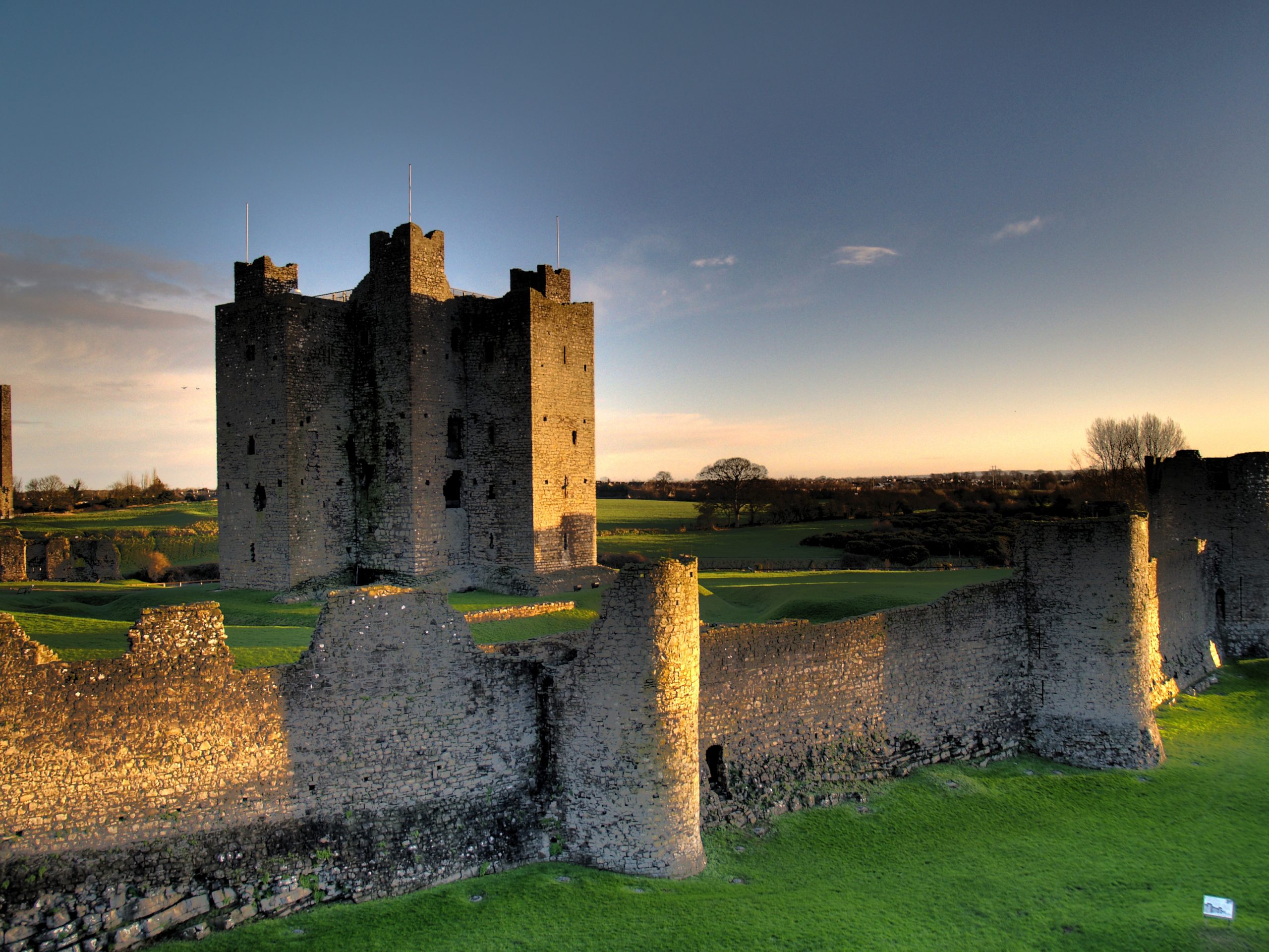
To explore Norman monuments in co. Meath such as Trim castle (pictured), check out the National Monuments Service’s Historic Environment Viewer.
For more information on the Normans in Meath, see:
- Arlene Crampsie and Francis Ludlow (eds), Meath: History and Society. Interdisciplinary Essays on the History of an Irish County (Dublin, 2017), especially chapters by A.S.K. Abraham, ‘Upward mobility and seigneurial residences in late medieval Meath’ and Noel French, ‘Hugh de Lacy’s legacy’.
- Eric St John Brooks, ‘A charter of John de Courcy to the Abbey of Navan’, The Journal of the Royal Society of Antiquaries of Ireland, Vol. 63 (1933) pp. 38-45.
- Daniel Brown, Hugh de Lacy, first earl of Ulster: rising and falling in Angevin Ireland (Woodbridge, 2016).
- Colin Veach, Lordship in four realms: the Lacy family, 1166-1241 (Manchester, 2014).
To learn more about the county of Mayo and its history more generally, check out our ‘Knowledge Graph for Irish History’: https://kg.virtualtreasury.ie/place/present-day/county/Meath/v189psd
Monaghan
What is now the county of Monaghan was part of the medieval kingdom of Airgialla (Oriel), ruled, at the time of the Anglo-Norman invasion, by the Ua Cerbaill (O’Carroll) family and later by the Meic Mathgamna (MacMahons). To discover more about those connected with the Norman expansion into the region, see:
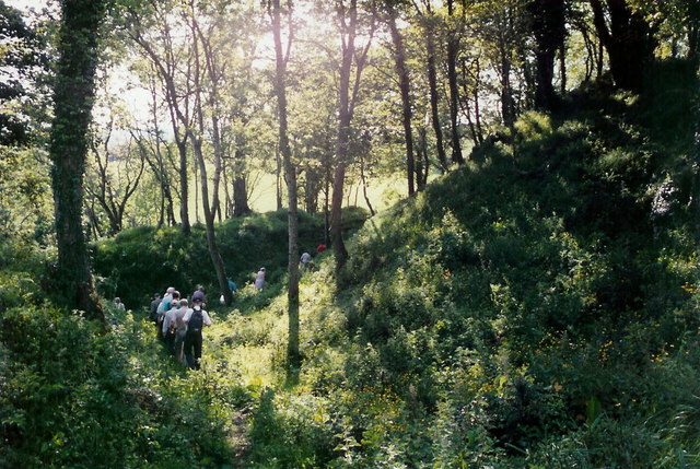
To explore Norman monuments in co. Monaghan such as Mannan castle (pictured), check out the National Monuments Service’s Historic Environment Viewer.
For more information on the Normans in Monaghan, see:
- Patrick J. Duffy and Éamonn Ó Ciardha (eds), Monaghan: History and Society. Interdisciplinary Essays on the History of an Irish County (Dublin, 2017), especially chapters by Eoghan Moore, ‘Fernmag alias Farney: kings and lineages c.882-1193’; Katharine Simms, ‘Monaghan in the later middle ages’; and Seosamh Ó Dufaigh, ‘Church lands in medieval Monaghan’.
To learn more about the county of Monaghan and its history more generally, check out our ‘Knowledge Graph for Irish History’: https://kg.virtualtreasury.ie/place/present-day/county/Monaghan/v19mw9h
Offaly
What is now the county of Offaly was part of the medieval kingdom of Uí Failge, from which the modern county gets its name though they were by no means coterminous. Several dynasties competed for dominance in this complex region at the time of the Anglo-Norman invasion, including the Uí Dímmusaig (O’Dempsey) of Clann Máelugra, Uí Maoilmuaid (O’Molloy) of Fir Cell, Mac Cochláin (MacCoughlan) of Delbna Ethra, and Mac Eochagáin (MacGeoghegan) of Cenél Fiachach, while the Uí Chonchobair Failge (O’Conor Faly) remained important throughout the later Middle Ages. To discover more about those connected with the Norman expansion into the region, see:
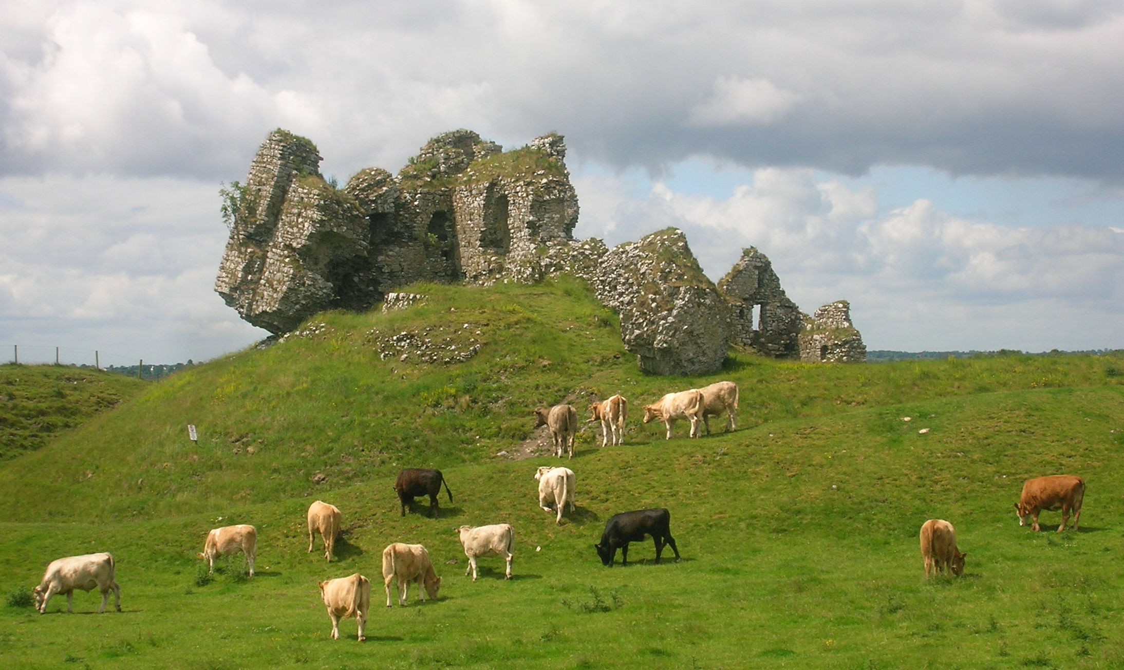
To explore Norman monuments in co. Offaly such as Clonmacnoise castle (pictured), check out the National Monuments Service’s Historic Environment Viewer.
For more information on the Normans in Offaly, see:
- Caimin O’Brien, ‘The earthwork castles of Anglo-Norman Offaly’ in William Nolan and Timothy O’Neill (eds), Offaly: History and Society. Interdisciplinary Essays on the History of an Irish County (Dublin, 1998).
- Goddard Henry Orpen, ‘The Fitz Geralds, Barons of Offaly’, The Journal of the Royal Society of Antiquaries of Ireland Ser. 6, Vol. 4 (1914) pp. 99-113.
To learn more about the county of Offaly and its history more generally, check out our ‘Knowledge Graph for Irish History’: https://kg.virtualtreasury.ie/place/present-day/county/Offaly/v13ng4s
Roscommon
What is now the county of Roscommon was largely under the overlordship of the Uí Chonchobair (O’Conor) kings of Connacht at the time of the Anglo-Norman invasion and for centuries later, though the Uí Chellaig (O’Kelly), kings of Uí Maine, had a presence in the south, the Meic Diarmata (MacDermott) being kings of Mag Luirg at the northern end of the later county. To discover more about those connected with the Norman expansion into the region, see:
Also, check out our Knowledge Graph linked events for this county:
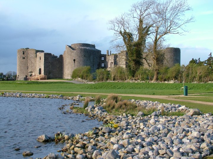
To explore Norman monuments in co. Roscommon such as Roscommon castle (pictured), check out the National Monuments Service’s Historic Environment Viewer.
For more information on the Normans in Roscommon, see:
- Kieran O’Conor and Thomas Finan, ‘Medieval settlement in north Roscommon, c.1200AD – c.1350AD’ in Richie Farrell, Kieran O’Conor and Matthew Potter (eds), Roscommon: History and Society. Interdisciplinary Essays on the History of an Irish County (Dublin, 2018).
- Goddard Henry Orpen, ‘Athlone Castle: Its early History, with Notes on some Neighboring Castles’, The Journal of the Royal Society of Antiquaries of Ireland, Vol. 37 (1907) pp. 257-276.
- Helen Perros (neé Walton), ‘Crossing the Shannon frontier: Connacht and the Anglo-Normans, 1170-1224’ in Terry Barry, Robin Frame and Katharine Simms (eds), Colony and frontier in medieval Ireland. Essays presented to JF Lydon (London, 1995), pp. 117-138.
To learn more about the county of Roscommon and its history more generally, check out our ‘Knowledge Graph for Irish History’: https://kg.virtualtreasury.ie/place/present-day/county/Roscommon/v1tsf71
Sligo
What is now the county of Sligo was under the overlordship of the Uí Chonchobair (O’Conor) kings of Connacht, though the Uí Ruairc (O’Rourke) of Bréifne had a stronger presence on the ground at the time of the Anglo-Norman invasion, and it would subsequently become a target of the kings of Tír Chonaill to the north. The region had its own sub-kingdoms, including Luigne whose kings bore the surname Ua Gadra (O’Gara). To discover more about those connected with the Norman expansion into the region, see:
Also, check out our Knowledge Graph linked events for this county:
To explore Norman monuments in co. Sligo such as Ballymote castle (pictured), check out the National Monuments Service’s Historic Environment Viewer.
For more information on the Normans in Sligo, see:
- Kieran O’Conor, ‘The Anglo-Normans in Co. Sligo’ in William Nolan and Kieran O’Conor (eds), Sligo: History and Society. Interdisciplinary Essays on the History of an Irish County (Dublin, 2024).
To learn more about the county of Sligo and its history more generally, check out our ‘Knowledge Graph for Irish History’: https://kg.virtualtreasury.ie/place/present-day/county/Sligo/v17sy7r
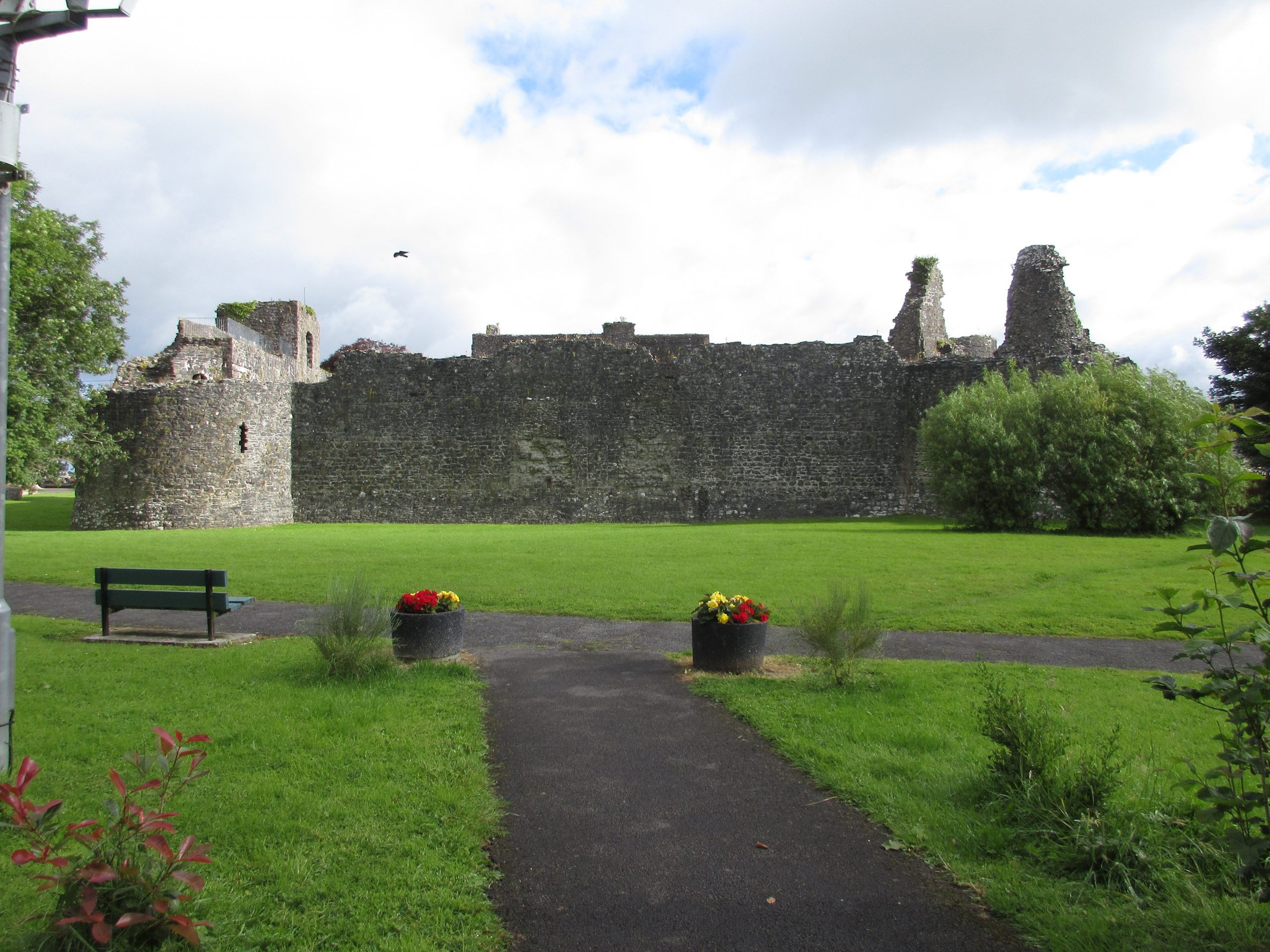
Tipperary
What is now the county of Tipperary was not a single entity prior to the Anglo-Norman invasion but was contested by several neighbouring dynasties. The big powers in the region were the Uí Briain kings of Tuadmumain (Thomond, North Munster) and the Meic Carthaig (MacCarthy), kings of Eóganacht Chaisil. But under them, sub-kings dominated including, in the north of the modern-day county, the Uí Cherbaill (O’Carroll) controlled the kingdom of Éile Tuaiscirt (which became known as Ely O’Carroll), while the lands of the Múscraige Tíre around Nenagh came under the control of a branch of Dál Cais bearing the surname Ua Chennétig (O’Kennedy). To discover more about those connected with the Norman expansion into the region, see:
Also, check out our Knowledge Graph linked events for this county:
To explore Norman monuments in co. Tipperary such as Knockgraffon motte (pictured), check out the National Monuments Service’s Historic Environment Viewer.
For more information on the Normans in Tipperary, see:
- William Nolan and Thomas McGrath (eds), Tipperary: History and Society. Interdisciplinary Essays on the History of an Irish County (Dublin, 1985), especially chapters by John Bradley, ‘The medieval towns of Tipperary’ and Canon Adrian Empey, ‘The Norman period, 1185-1500’.
- Edmund Curtis, ‘Sheriff’s accounts for County Tipperary 1275-6’, Proceedings of the Royal Irish Academy C, Vol. 42 (1934/35) pp. 65-95.
- Canon Adrian Empey, ‘Conquest and Settlement: Patterns of Anglo-Norman Settlement in North Munster and South Leinster’ in James Muldoon (ed.), The North Atlantic frontier of medieval Europe. Vikings and Celts (Farnham, 2009), pp. 257-84.
- —’Medieval Thurles: origin and development’ in William Corbett and William Nolan (eds), Thurles, the cathedral town: essays in honor of Archbishop Thomas Morris (Dublin, 1989), pp. 30-39.
- —‘The Anglo-Norman Community in Tipperary and Kilkenny in the Middle Ages: Change and Continuity’ in Gearóid MacNiocaill and Pat Wallace (eds), Keimelia: Studies in Medieval Archeology and History in Memory of Tom Delaney (Galway, 1988), pp. 449-467.
- —‘The Anglo-Norman settlement in the Cantred of Eliogarty’ in John Bradley (ed.), Settlement and Society in Medieval Ireland. Studies Presented to FX Martin, OSA (Kilkenny, 1988), pp. 207-228.
- Goddard Henry Orpen, ‘The Mote of Knockgraffon’, The Journal of the Royal Society of Antiquaries of Ireland, Vol. 39 (1909) pp. 275-277.
To learn more about the county of Tipperary and its history more generally, check out our ‘Knowledge Graph for Irish History’: https://kg.virtualtreasury.ie/place/present-day/county/Tipperary/v1rwq33
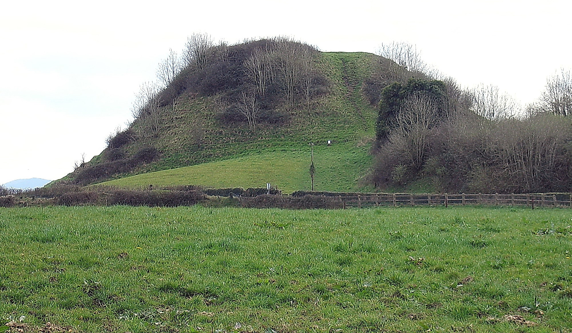
Tyrone
What is now the county of Tyrone was the heart of the medieval kingdom of the Cenél nEógain, one of the most important dynasties on the island. At the time of the Anglo-Norman invasion, the kingdom was ruled by the Mac Lochlainn family; however, the death of Muirchertach Mac Lochlainn in 1166 marked their eclipse from national politics, and the kingdom came rapidly to be associated with their distant kinsmen bearing the surname Ua Néill (O’Neill) who would emerge in time as the dominant force in Gaelic power in Ireland. To discover more about those connected with the Norman expansion into the region, see:
Also, check out our Knowledge Graph linked events for this county:
To explore Norman monuments in co. Fermanagh such as Harry Avery’s Castle (pictured), check out the Historic Environment Viewer for Northern Ireland.
For more information on the Normans in Tyrone, see:
- Katharine Simms, ‘Late Medieval Tír Eoghain: The Kingdom of “the Great Ó Néill”’ in Charles Dillon and Henry A. Jefferies (eds), Tyrone: History and Society. Interdisciplinary Essays on the History of an Irish County (Dublin, 2000).
- Goddard Henry Orpen, ‘The Normans in Tirowen and Tirconnell’, The Journal of the Royal Society of Antiquaries of Ireland Ser. 6, Vol. 5 (1915) pp. 275-288.
To learn more about the county of Tyrone and its history more generally, check out our ‘Knowledge Graph for Irish History’: https://kg.virtualtreasury.ie/place/present-day/county/Tyrone/v19rw2v
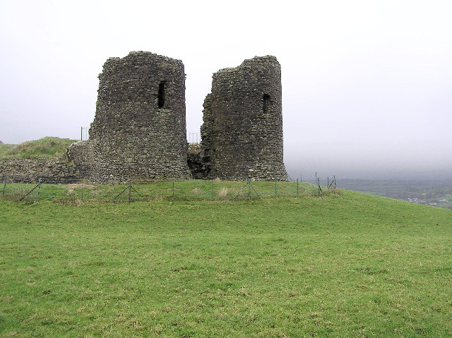
Waterford
What is now the county of Waterford corresponds reasonably closely to what was the medieval kingdom of the Déisi Muman, ruled by the Uí Fáeláin (O’Phelan) dynasty, with the Uí Bric (O’Brick) being dominant in western parts. The city of Waterford itself was primarily controlled by the Hiberno-Norse, though it was under the suzerainty of its powerful neighbours, alternating between the Uí Briain of Tuadmumain (Thomond, North Munster) and the Meic Carthaig of Desmumain (Desmond, South Munster). To discover more about those connected with the Norman expansion into the region, see:
Also, check out our Knowledge Graph linked events for this county:
- Siege and capture of Waterford, 1170
- Expedition of Henry II, 1171-2
- Expedition of John, lord of Ireland, 1185
To explore Norman monuments in co. Waterford such as Dunhill castle (pictured), check out the National Monuments Service’s Historic Environment Viewer.
For more information on the Normans in Waterford, see:
- William Nolan and Thomas Power (eds), Waterford: History and Society. Interdisciplinary Essays on the History of an Irish County (Dublin, 1992), especially chapters on ‘The topographical development of Scandinavian and Anglo-Norman Waterford City’; Anglo-Norman County Waterford 1200-1300’; and ‘Mayors and merchants in medieval Waterford 1169-1495’.
- Edmund Curtis, ‘Sheriffs’ accounts of the Honor of Dungarvan, of Tweskard in Ulster, and of County Waterford, 1261-63’, Proceedings of the Royal Irish Academy C, Vol. 39 (1929/31) pp. 1-17.
- James F. Lydon, ‘Medieval Waterford’, Decies. Journal of the Waterford Archaeological and Historical Society (1981) pp. 12-19.
- —’The city of Waterford in the later middle ages’, Decies. Journal of the Waterford Archaeological and Historical Society (1979), pp. 5-15.
To learn more about the county of Waterford and its history more generally, check out our ‘Knowledge Graph for Irish History’: https://kg.virtualtreasury.ie/place/present-day/county/Waterford/v19xp4z
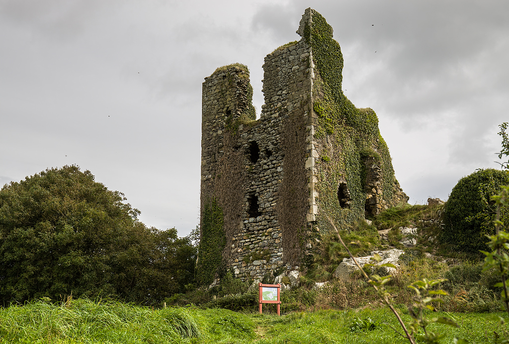
Westmeath
What is now the county of Westmeath was at the core of the once great kingdom of Mide at the time of the Anglo-Normans invasion, its kings bearing the surname Ua Máelsechlainn (O’Melaghlin). By then, though, it was being fought over by neighbouring powers, including the Uí Chonchobair (O’Conor) kings of Connacht and the Uí Ruairc (O’Rourke) kings of Bréifne. It fell very rapidly into Anglo-Norman hands when granted to Hugh de Lacy by King Henry II in 1172. To discover more about those connected with the Norman expansion into the region, see:
To explore Norman monuments in co. Westmeath such as Delvin castle (pictured), check out the National Monuments Service’s Historic Environment Viewer.
For more information on the Normans in Westmeath, see:
- Rory Masterton, ‘The Anglo-Norman conquest and settlement’ in Seamus O’Brien and William Nolan (eds), Westmeath: History and Society. Interdisciplinary Essays on the History of an Irish County (Dublin, 2022).
- Goddard Henry Orpen, ‘Athlone Castle: Its early History, with Notes on some Neighboring Castles’, The Journal of the Royal Society of Antiquaries of Ireland, Vol. 37 (1907) pp. 257-276.
- —‘The Mote of Castlelost, County Westmeath’, The Journal of the Royal Society of Antiquaries of Ireland Vol. 40 (1910) pp. 226-228.
- — ‘The Mote of Street, County Westmeath’, The Journal of the Royal Society of Antiquaries of Ireland Vol. 40 (1910) pp. 214-222.
To learn more about the county of Westmeath and its history more generally, check out our ‘Knowledge Graph for Irish History’: https://kg.virtualtreasury.ie/place/present-day/county/Westmeath/v15tc4h
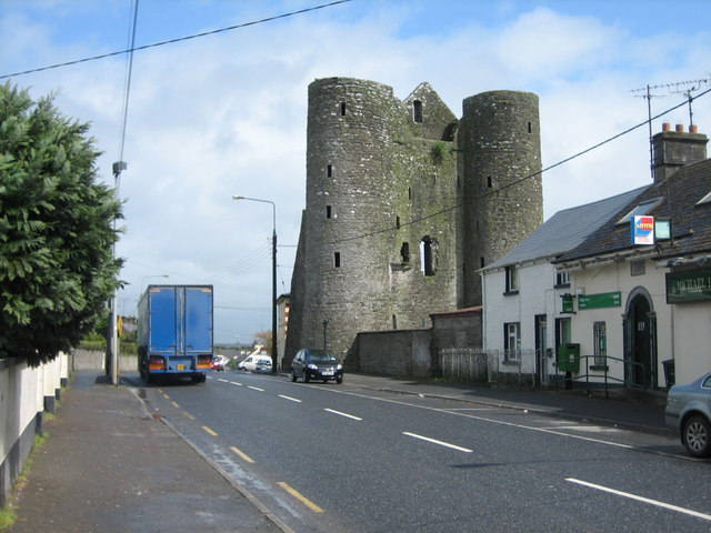
Wexford
What is now the town and county of Wexford was part of the kingdom of Uí Cheinnselaig at the time of the Anglo-Norman invasion, ruled by the Meic Murchada (MacMurrough) from Ferns. The town of Wexford itself was a Hiberno-Norse foundation, though the Meic Murchada had long since come to dominate it. To discover more about those connected with the Norman expansion into the region, see:
Also, check out our Knowledge Graph linked events for this county:
To explore Norman monuments in co. Wexford such as Dunbrody abbey (pictured), check out the National Monuments Service’s Historic Environment Viewer.
For more information on the Normans in Wexford, see:
- Billy Colfer, ‘Anglo-Norman settlement in county Wexford’ in Kevin Whelan and William Nolan (eds), Wexford: History and Society. Interdisciplinary Essays on the History of an Irish County (Dublin, 1987).
- —Arrogant Trespass: Anglo-Norman Wexford, 1169-1400 (repr. Dublin, 2019).
- Goddard Henry Orpen, ‘The Battle of Dundonnell (Baginbun), AD 1170’, The Journal of the Royal Society of Antiquaries of Ireland, Vol. 34 (1904) pp. 354-360.
- —‘The Carew, Baginbun, and Fethard Castle Inscriptions’, The Journal of the Royal Society of Antiquaries of Ireland, Vol. 34 (1904) pp. 261-270.
To learn more about the county of Wexford and its history more generally, check out our ‘Knowledge Graph for Irish History’: https://kg.virtualtreasury.ie/place/present-day/county/Wexford/v1mv77g
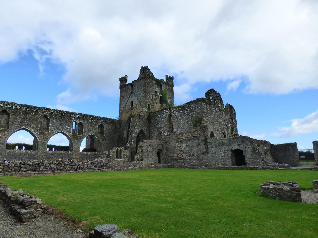
Wicklow
What is now the county of Wicklow, the last of Ireland’s 32 counties to be shired, in 1606, was (apart from the vast tracts of land in the hands of the great church of Glendalough) a complex patchwork of lesser kingdoms at the time of the Anglo-Norman invasion, all under the overlordship of the Meic Mhurchada kings of Leinster. But these would soon be pushed aside by dynasties fleeing the colonisation of what would become County Kildare, families like the Uí Broin (O’Byrne) and Uí Tuathail (O’Toole). To discover more about those connected with the Norman expansion into the region, see:
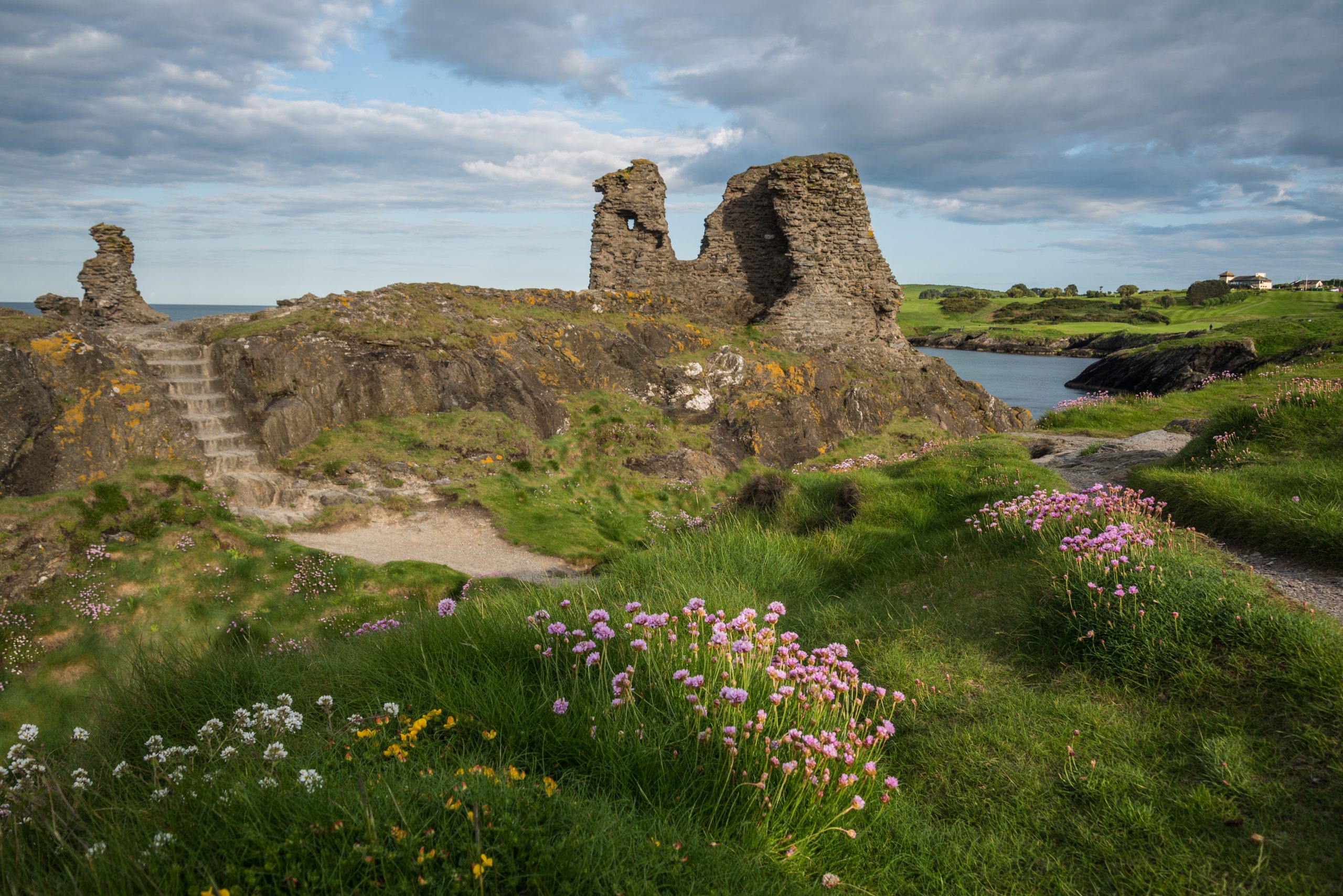
To explore Norman monuments in co. Wicklow such as the remains of Black castle (pictured), check out the National Monuments Service’s Historic Environment Viewer.
For more information on the Normans in Wicklow, see:
- James F. Lydon, ‘Medieval Wicklow – “a Land of War”’ in Ken Hannigan and William Nolan (eds), Wicklow: History and Society. Interdisciplinary Essays on the History of an Irish County (Dublin, 1994).
- Eric St. John Brooks, ‘The De Ridelesfords’, The Journal of the Royal Society of Antiquaries of Ireland, Part 1, Vol. 81 (1951) pp. 115-138; Part 2, Vol. 82 (1952) pp. 45-61.
- Goddard Henry Orpen, ‘Castrum Keyvini: Castlekevin’, The Journal of the Royal Society of Antiquaries of Ireland, Vol. 38 (1908) pp. 17-27.
- —’Novum Castrum McKynegan, Newcastle, Co. Wicklow’, The Journal of the Royal Society of Antiquaries of Ireland, Vol. 38 (1908) pp. 126-140.
To learn more about the county of Wicklow and its history more generally, check out our ‘Knowledge Graph for Irish History’: https://kg.virtualtreasury.ie/place/present-day/county/Wicklow/v1kx4w8