Uncover, Create and Share History Together: A Public History Project
Katie Leach and Alyssa McIltrot are students at Trinity College Dublin pursuing their masters in Public History and Cultural Heritage. Prior to Trinity, Leach was a museum professional prioritising engagement opportunities for young people and marginalised communities. McIltrot worked as a research consultant for museums in the Washington D.C. area specialising in their genealogical departments.
Within public history, there have been numerous attempts at documenting shared authority in practice, though this is still a burgeoning field with successful use still evolving. Leach and McIltrot felt there was a knowledge gap in the methodology for solely virtual shared authority projects within the archive. Their research question centred on this idea in order to facilitate a community curated display in a fully virtual setting. Their reasoning aligned with the public history concept of shared authority, as ideas of shared authority emphasise the importance of embedding collaboration between practitioner and participants, thus highlighting the history of the collective experience over that of the individual narrative.1 In researching possibilities for the VRTI to expand on its public history practices, they found an opportunity to further develop visible community involvement.

Over four weeks, five community volunteers from across Ireland participated in the “Uncover, Create, and Share History Together” project. These volunteers, recruited through the Irish Community Archive Network’s newsletter, engaged in a series of online meetings to collaboratively develop a research project. During these sessions, the volunteers participated in various activities to deepen their knowledge of the Virtual Record Treasury of Ireland and enhance their digital archival research skills. They developed and carried out this project with the support of the VRTI and the Irish Community Archive Network (iCAN).
The following presentation is the culmination of their hard work.
1 Mary Hutchison, “Shared Authority.” in Museums and Communities: Curators, Collections and Collaboration. Ed. Viv Golding, and Wayne Modest. (London: Bloomsbury Academic, 2013).
Transplantation to Kilgeever, Co, Mayo 1654-58
 IMC 1970/Transplantation (The transplantation to Connacht, 1654-58)
Selected by Deirdre McGuirk. Deirdre McGuirk is a Public Historian and Freelance Tour Guide working with the National Museum of Ireland Country Life, Westport Walking Tours and Glen Keen Farm in Co. Mayo. Deirdre has been studying cilliní (children’s burial grounds) for a number of years from a public and social history perspective. Deirdre is a member of Louisburgh Killeen Heritage and the Irish Community Archive Network (iCAN).
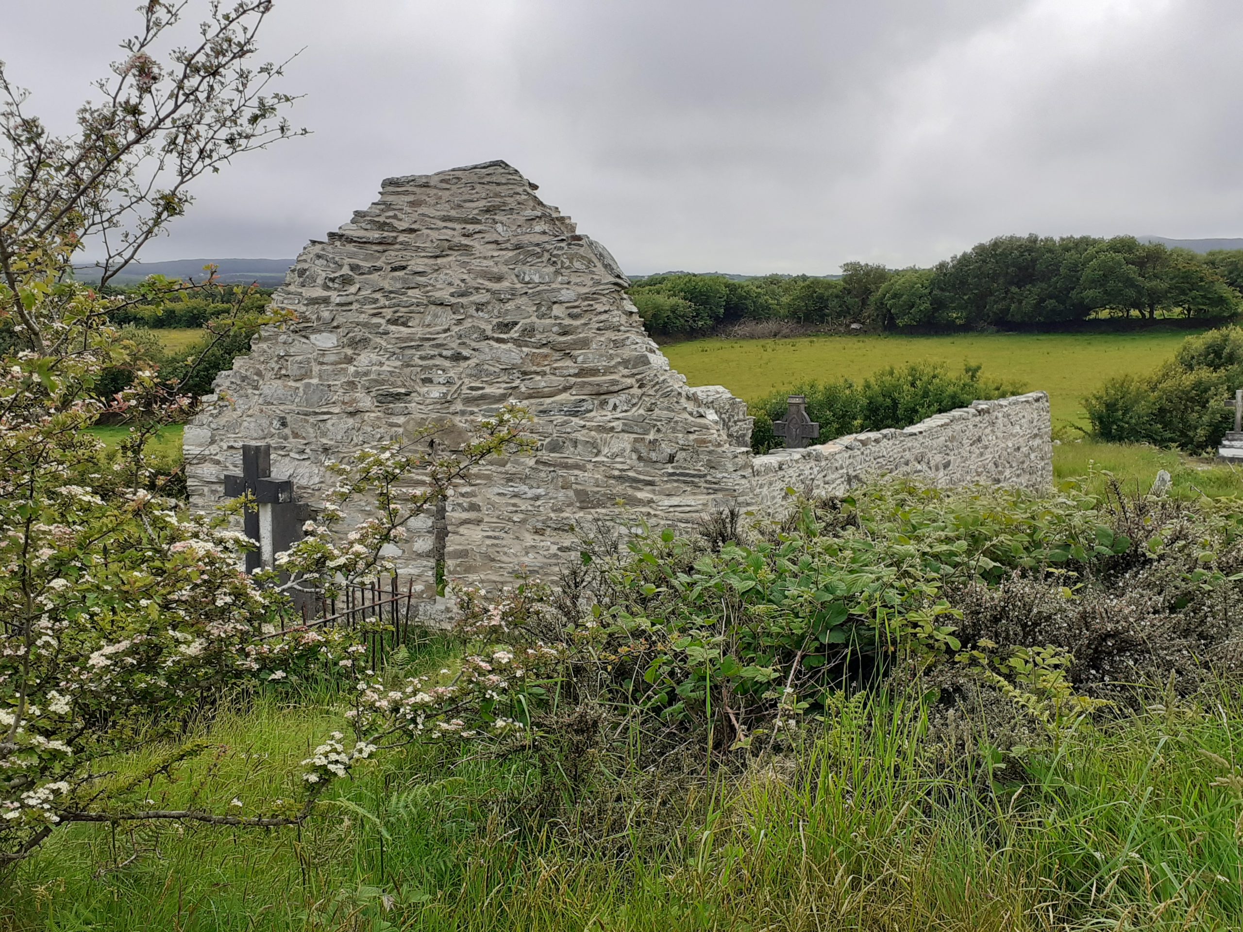
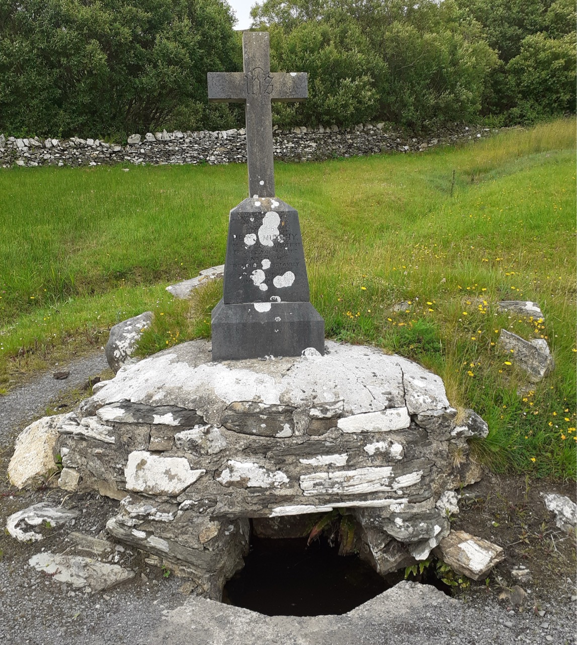
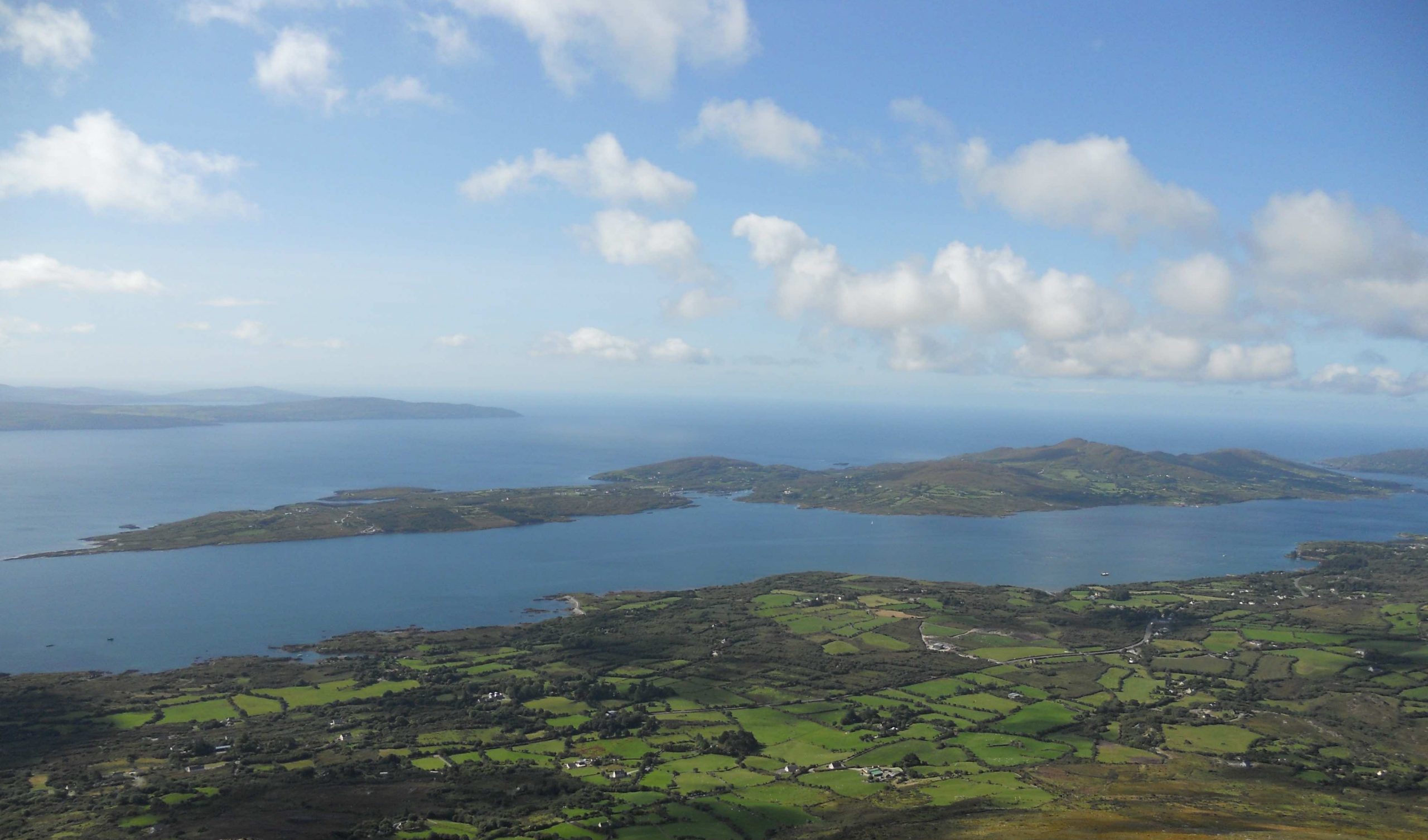
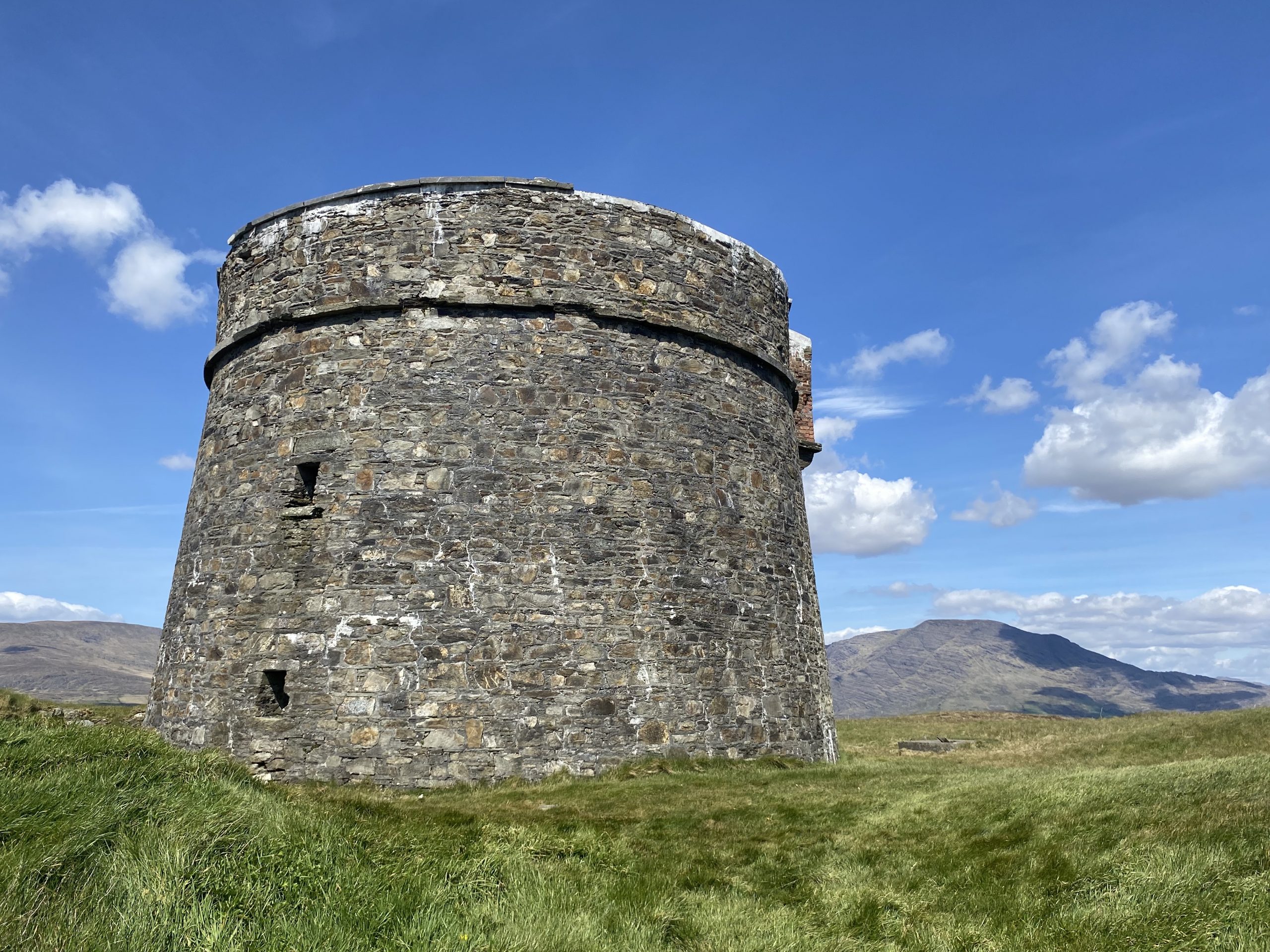
Kilgeever Abbey, located in the barony of Murrisk, Co. Mayo is a Medieval church on a site containing a holy well and cemetery. The Virtual Record Treasury of Ireland contains a document that records people who were transplanted to Connacht between 1654 and 1658. This includes a record of people transplanted to the parish of Kilgeever.
The barony of Murrisk was reserved for transplantation for inhabitants from Ulster excluding Counties Down and Antrim, however, people from within Co. Mayo were also transplanted to Kilgeever. The introduction to the report written in 1970 states that the transplantation to Connacht failed. Many transplantation laws were passed in the 1600s and constant reversal of acts led to ‘frustration, fraud and injustice’.
In Murrisk, 22,342 Irish acres were awarded to transplanters, with 1,892 acres being awarded to people from within Mayo, 19,570 acres to people from outside Mayo and 880 acres awarded to the church.
The following are three examples of land in Kilgeever awarded to transplanters from Co. Mayo:
| Transplanter | Original address | Irish acres |
| Bourke, David | Monulla | 500 |
| Bourke, Jannett alias Garvey | unknown | 122 |
| Jordan, William | Bellaha | 386 |
Some of the reasons for the failure of the transplantation were some Protestant landowners making private settlements on their estates and taking repossession of mortgaged lands. Some hid ownership of land under the local lord’s name. It is unknown how successful transplantation to Kilgeever was but just over one hundred years later the town of Louisburgh in Kilgeever was built in 1795. Prior to the Famine Kilgeever had a population of 12,573 which had nearly halved by 1841 (John Lyons, Louisburgh a history (Mayo, 1995), p. 2 and 66).
Early Quakers in Dublin 1689
Selected by Noelene Beckett Crowe. Noelene Beckett Crowe as a poet/writer has had several articles published within numerous magazines, periodicals, historical journals & ezines. She has contributed to National Museum of Ireland iCan Project with several articles/poems to Miscellaneous Places/Topics & Poetry Inspired by Irish Heritage. Has contributed to Cathair na Mart Historical Journal, Federation of Local History Societies, Kathleen Kilbane: The Little Saint of Achill Island & The Kathleen Kilbane Story.
The efforts of the Quakers to assist Dubliners is a testament to social history of the area. The initial meeting house in Sycamore Alley opened during 1692 then they met in No. 57 South William Street. Four meeting houses now are located in Eustace Street, Churchtown, Monkstown and Rathfarnham. Rathgar Junior school has a Quaker-ethos. Cork Street Fever Hospital and Donnybrook’s Royal Hospital were founded by Quakers during the early nineteenth century. A Quaker graveyard was established in Cork Street with one in York Street. Their burial ground is in Temple Hill, Blackrock. They were known for their entrepreneurship: they set up several businesses in Ireland with families such as the Goodbodys, Bewleys, Pims, Lambs, Jacobs, Edmundsons, Perrys, and Bells involved in diverse areas i.e. milling, textiles, shipping, imports, exports, food, tobacco production, brewing, iron production & railway industries. Archives of the Religious Society of Friends are held within Quaker House in Rathfarnham.
Read about a Quaker from New York who saved many lives in Ireland here: https://www.ouririshheritage.org/content/archive/people/101_mayo_people/arts-craft-and-culture/asenath-hatch-nicholson
Nationalibus Thesaurum
Archival restoration, duplication
Incunabula, annals, folios, tomes
Facsimiles, codices, scrolls
Cenci, registers, tracts, catalogues
Handwritten documents, deeds
Typed correspondence
Printed material, transcripts
Surveys, reports, bills
Images, personages, maps
Tribute due to conservators.
Noelene Beckett Crowe, May 2024
The French and Bantry Bay, 1776
TNA HO 100/71/37 (Deposition of sailor taken aboard by French)
Selected by Helen Riddell. Helen Riddell works for Bere Island Projects Group (BIPG) tasked with implementing the Bere Island Conservation Plan. BIPG was formed in 1987 as a community development group and works to ensure that Bere Island remains a viable and vibrant community. In 2003 with support from The Heritage Council the group launched the Bere Island Conservation Plan which serves to document and protect the island’s cultural, archaeological and architectural heritage and its biodiversity. BIPG has been a member of the Irish Community Archive Network since 2022.
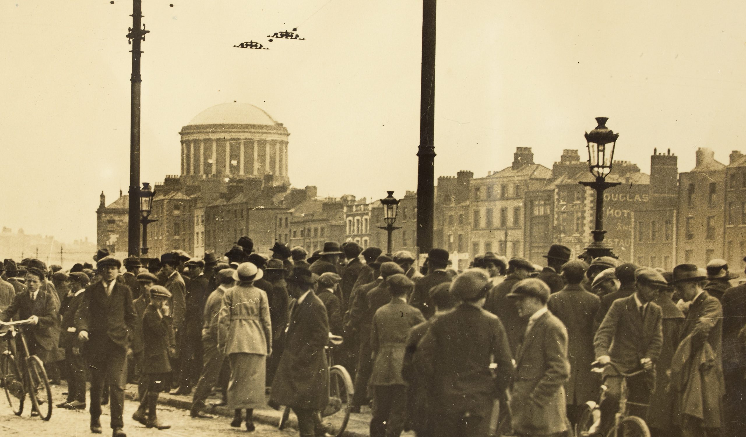
When a French Armada entered Bantry Bay on 22nd December 1796, its primary aim was to assist the outlawed Society of United Irishmen, an Irish republican group in their rebellion against British rule. The French, under the command of General Hoche and inspired by Wolfe Tone, planned to land a large force in Ireland, joining with the United Irishmen to drive the British out of Ireland.
Island folklore reports that the French fleet were first spotted by some local fishermen. The alarm was raised by a Captain Dan O’Sullivan of Castletownbere, who sent word to the area’s landlord Richard White of Bantry who called in his corps of yeomanry to set up a chain of outposts along the Sheep’s Head Peninsula overlooking the bay.
By December 23rd eighteen French warships were anchored between Bere Island and Sheep’s Head. On Christmas Eve, a longboat from one of the ships La Resolue was blown ashore onto the eastern end of Bere Island, the officer of the longboat Lieutenant Proteau and his crew were arrested by Captain O’Sullivan. Proteau was taken to Bantry House to be questioned by General Dalrymple. The remainder of the storm battered fleet left the bay and returned to France without achieving any of their objectives.
Bere Island author Ted O’Sullivan recounts in his book Bere Island a Short History Island “The population of the island was terrified at the prospect of an invasion as the area was very peaceful at time. People drove their stock to the hills and took turns watching the fleet. A lasting mark was left on the folk memory and many islanders can tell you which of their ancestors saw the French fleet.”
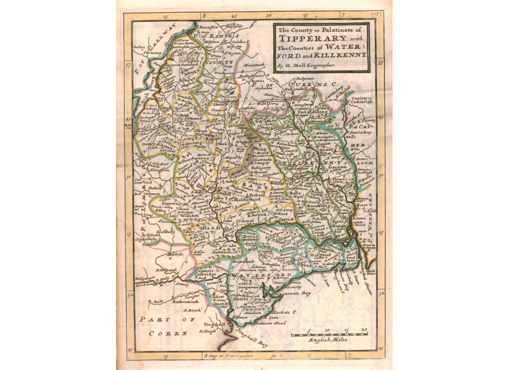
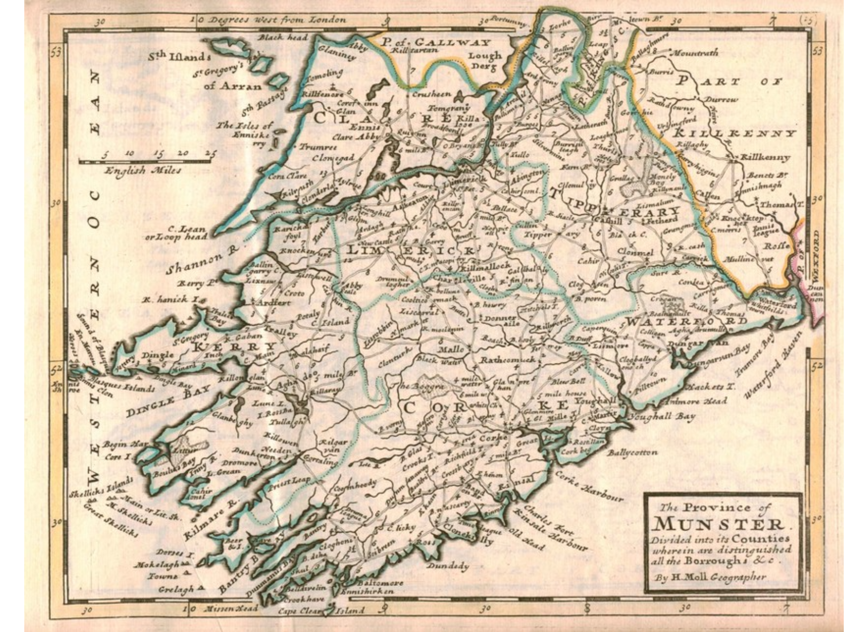
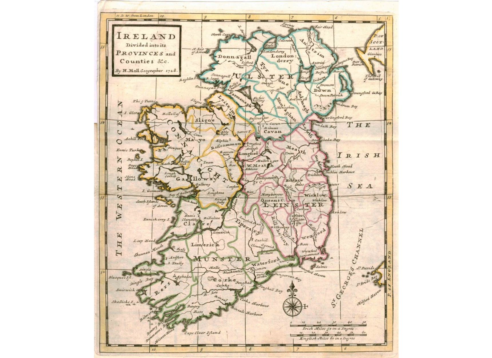
A Virtual Encounter with a Transcript and a 300 Year Old Atlas
PRONI T755/3 (Transcripts of Pelham Papers, vol 3)
LBC Atlas 1 (A Set of Twenty New and Correct Maps of Ireland)
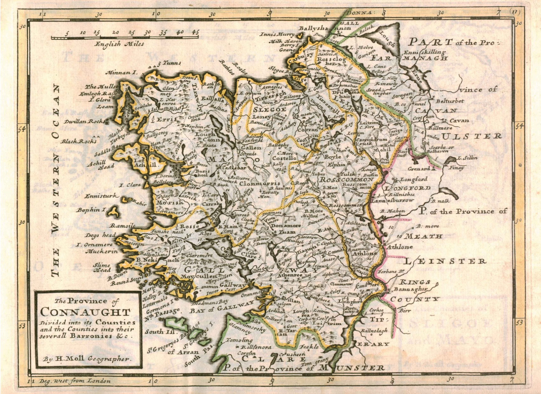
Selected by Katy Goodhue. Katy Goodhue is a visual artist living and working in the Slieveardagh Hills, Co. Tipperary, and is part of a group who are collecting and saving the history and heritage of the local coalmining community. She also works with children and community groups using heritage, history and nature as themes or starting points for projects- information that is relevant and accessible gives participants ownership of and pride in their heritage.
The Virtual Treasury isn’t really there. It’s virtual – having the effect, but not the form of. It’s a treasury – a storage place, and for me; to what end. The time was short and we decided on a group response heavy with images. The material chosen by others in the group was interesting, I went through it looking for place, time and context.
In the Pelham Papers Vol. 3 I searched the word ‘Tipperary’ and on page 286 ‘…move forward to Tipperary occupying Cashel, Thurles and Urlingford.’ – my local towns. The year is 1796 and in pages 285 to 289, are instructions to General Officers commanding Columns. The columns are marching towards Cork, but the possibility is that they may be needed at either Shannon or Galway rather than at Bantry. This is to be addressed through redirecting the columns. The men are to occupy and wait for further orders in twenty-nine named towns and villages.
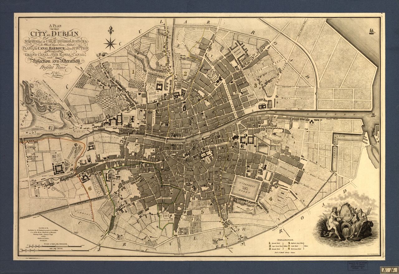
In the Map Room of the Virtual Treasury I found my image choices in ‘the first atlas to accurately depict the road network in Ireland.’ I have used five maps from this atlas to go with the text from the Pelham Papers. Each map image used includes the locations named by Pelham in the accompanying text. Studying the maps allows the viewer to consider the directions to, distances between and locations of these places that the men were to occupy. The maps are from 1728 and the include the towns and villages named by Pelham. Might Pelham or the Generals have referred to these maps?
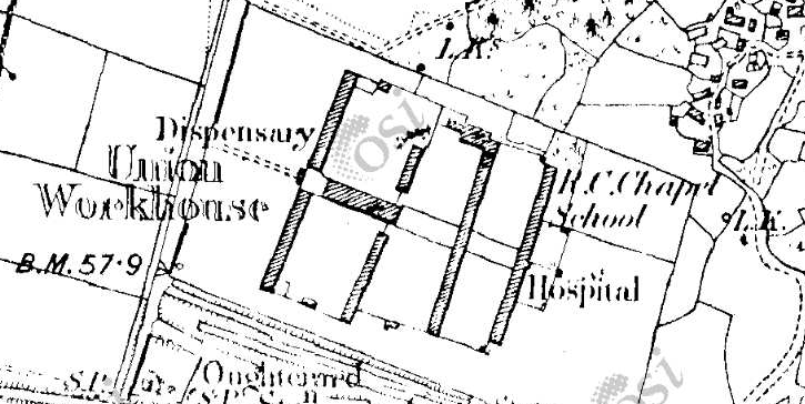
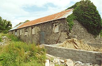
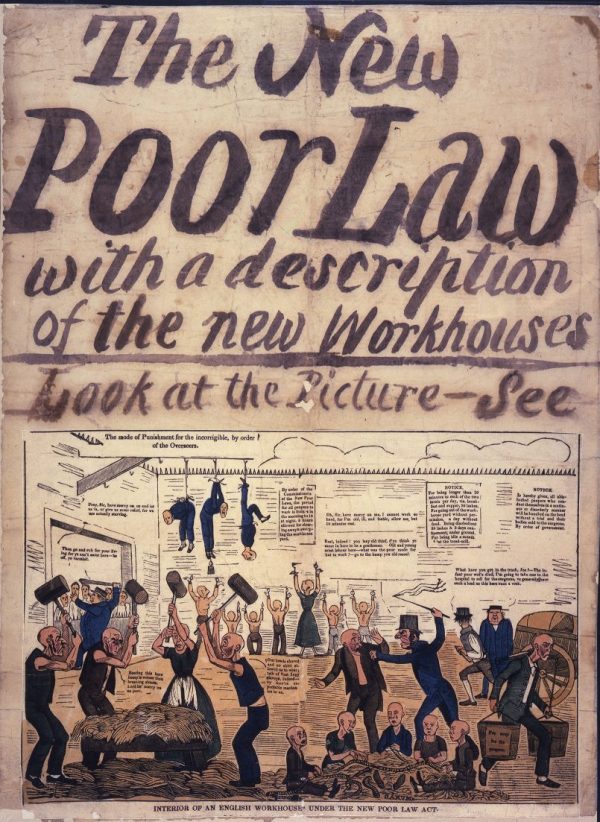
Oughterard Workhouse and the Irish Poor Law, 1854
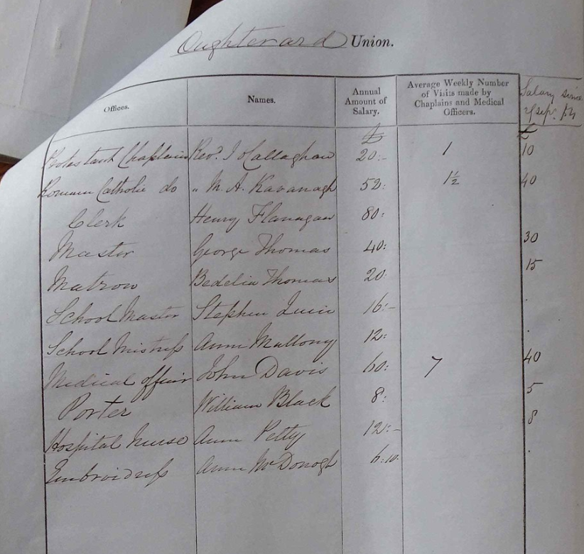
ParliamentUK 10/32/165/133 – Return of workhouse staff for the Poor Law District of Oughterard
Selected by Jack Connolly. Jack Connolly is an archaeologist and historian currently working with the Oughterard Community Heritage Group, where he is active in a wide variety of community projects, including the group’s flagship Courthouse 2024 project. He also holds a place on the ruling committee of the Galway Archaeological and Historical Society, and specialises in the Archaeology of Culture, Memory and Mythology.
When speaking of social history in Ireland, few things are as emblematic of the societal divides which existed here than the much-maligned Workhouse. Widely criticised by many, they were a response to the stark poverty which had been sweeping across Britain and Ireland, but they became particularly infamous during the Great Famine in Ireland.
The effect of these workhouses cannot be understated. They have made a long-lasting and profound mark on the social history of Ireland as a whole, and left behind scars which are still felt to this day.